Area Overview for M35 0WR
Photos of M35 0WR
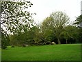


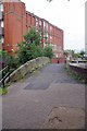
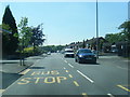
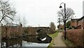

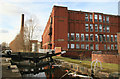
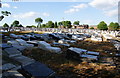
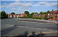
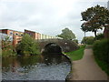
28 photos from this area
Area Information
Key information about the M35 0WR including its size, population, and administrative classification.
- Area Type
- Postcode
- Area Size
- 5403 m²
- Population
- 1193
- Population Density
- 6312 people/km²
House Prices in M35 0WR
17
Properties
£154,780
Average Sold Price
£78,950
Lowest Price
£380,000
Highest Price
Showing 17 properties
| Address | Type | Beds | Baths | Last Sale Price | Last Sale Date | |
|---|---|---|---|---|---|---|
| 78 Somerset Road, Failsworth, M35 0WR | Semi-detached | 3 | 1 | £269,950 | Jul 2023 | |
| 84 Somerset Road, Failsworth, M35 0WR | Semi-detached | 4 | 2 | £380,000 | Apr 2023 | |
| 74 Somerset Road, Failsworth, M35 0WR | house | - | - | £144,950 | Nov 2018 | |
| 94 Somerset Road, Failsworth, M35 0WR | Terraced | 3 | 1 | £88,500 | Aug 2016 | |
| 88 Somerset Road, Failsworth, M35 0WR | house | - | - | £130,500 | Sep 2014 | |
| 104 Somerset Road, Failsworth, M35 0WR | house | - | - | £157,000 | Feb 2012 | |
| 98 Somerset Road, Failsworth, M35 0WR | Terraced | - | - | £121,000 | Jun 2006 | |
| 102 Somerset Road, Failsworth, M35 0WR | house | - | - | £87,000 | Sep 2004 | |
| 76 Somerset Road, Failsworth, M35 0WR | Semi-detached | - | - | £89,950 | Dec 2002 | |
| 92 Somerset Road, Failsworth, M35 0WR | Terraced | - | - | £78,950 | Oct 2002 |
Page 1 of 2
Energy Efficiency in M35 0WR
Amenities
Schools
| Rank | School | Type | Entry gender | Ages |
|---|
Explore more schools in this area
Go to Schools tabDemographics
Household Size
Family (3-5 people)
most common
Accommodation Type
Houses
most common
Tenure
89
majority
Ethnic Group
White
most common
Religion
N/A
most common
Household Composition
N/A
most common
Age
47
median
Adults (30-64 years)
most common
Household Deprivation
N/A
with no deprivation
NS-SEC
27
in Lower managerial occupations
Explore more demographic insights in this area
Go to Demographics tabPlanning
Planning Constraints
- Flood RiskPremium
- Ramsar Wetland SitesPremium
- Area of Outstanding Natural BeautyPremium
- Protected Nature ReservePremium
- Protected WoodlandPremium