Area Overview for M34 2HH
Photos of M34 2HH
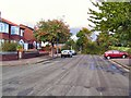
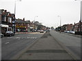
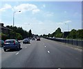
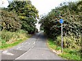
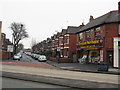
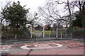
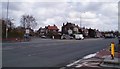
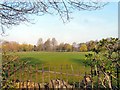
43 photos from this area
Area Information
Key information about the M34 2HH including its size, population, and administrative classification.
- Area Type
- Postcode
- Area Size
- 1.3 hectares
- Population
- 1554
- Population Density
- 1772 people/km²
House Prices in M34 2HH
39
Properties
£178,960
Average Sold Price
£46,500
Lowest Price
£320,000
Highest Price
Showing 39 properties
| Address | Type | Beds | Baths | Last Sale Price | Last Sale Date | |
|---|---|---|---|---|---|---|
| 183 Windsor Road, Denton, M34 2HH | house | - | - | £250,000 | Jul 2024 | |
| 157 Windsor Road, Denton, M34 2HH | Semi-detached | 3 | - | £280,000 | Feb 2024 | |
| 197 Windsor Road, Denton, M34 2HH | Semi-detached | 3 | 1 | £260,000 | Aug 2023 | |
| 141 Windsor Road, Denton, M34 2HH | house | - | - | £246,000 | Oct 2022 | |
| 133 Windsor Road, Denton, M34 2HH | Semi-detached | 3 | 1 | £220,000 | Dec 2021 | |
| 189 Windsor Road, Denton, M34 2HH | house | - | - | £320,000 | Dec 2021 | |
| 167 Windsor Road, Denton, M34 2HH | house | 4 | - | £292,000 | Sep 2021 | |
| 147 Windsor Road, Denton, M34 2HH | Semi-detached | 3 | - | £220,000 | Aug 2021 | |
| 139 Windsor Road, Denton, M34 2HH | Semi-detached | 3 | 1 | £180,000 | Dec 2020 | |
| 165 Windsor Road, Denton, M34 2HH | Semi-detached | 3 | 1 | £235,000 | Feb 2020 |
Page 1 of 4
Energy Efficiency in M34 2HH
Amenities
Schools
| Rank | School | Type | Entry gender | Ages |
|---|
Explore more schools in this area
Go to Schools tabDemographics
Household Size
Two person
most common
Accommodation Type
Houses
most common
Tenure
87
majority
Ethnic Group
White
most common
Religion
N/A
most common
Household Composition
N/A
most common
Age
47
median
Adults (30-64 years)
most common
Household Deprivation
N/A
with no deprivation
NS-SEC
33
in Lower managerial occupations
Explore more demographic insights in this area
Go to Demographics tabPlanning
Planning Constraints
- Flood RiskPremium
- Ramsar Wetland SitesPremium
- Area of Outstanding Natural BeautyPremium
- Protected Nature ReservePremium
- Protected WoodlandPremium