Area Overview for M33 5LT
Photos of M33 5LT
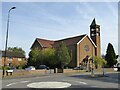
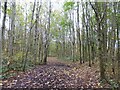
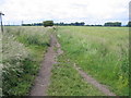
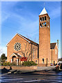
22 photos from this area
Area Information
Key information about the M33 5LT including its size, population, and administrative classification.
- Area Type
- Postcode
- Area Size
- 5861 m²
- Population
- 1755
- Population Density
- 299461 people/km²
House Prices in M33 5LT
23
Properties
£86,688
Average Sold Price
£20,010
Lowest Price
£142,000
Highest Price
Showing 23 properties
| Address | Type | Beds | Baths | Last Sale Price | Last Sale Date | |
|---|---|---|---|---|---|---|
| 22 Pear Tree Walk, Sale, M33 5LT | Terraced | 3 | - | £142,000 | Mar 2016 | |
| 24 Pear Tree Walk, Sale, M33 5LT | Terraced | 2 | - | £121,000 | Aug 2013 | |
| 30 Pear Tree Walk, Sale, M33 5LT | Flat | - | - | £73,500 | Aug 2012 | |
| 4 Pear Tree Walk, Sale, M33 5LT | house | 3 | - | £124,995 | Mar 2012 | |
| 7 Pear Tree Walk, Sale, M33 5LT | Flat | - | - | £69,000 | Mar 2012 | |
| 20 Pear Tree Walk, Sale, M33 5LT | house | - | - | £75,000 | Nov 2002 | |
| 18 Pear Tree Walk, Sale, M33 5LT | house | - | - | £68,000 | May 2002 | |
| 11 Pear Tree Walk, Sale, M33 5LT | Terraced | - | - | £20,010 | Jan 2001 | |
| 10 Pear Tree Walk, Sale, M33 5LT | Flat | - | - | - | - | |
| 1 Pear Tree Walk, Sale, M33 5LT | Flat | - | - | - | - |
Page 1 of 3
Energy Efficiency in M33 5LT
Amenities
Schools
| Rank | School | Type | Entry gender | Ages |
|---|
Explore more schools in this area
Go to Schools tabDemographics
Household Size
Family (3-5 people)
most common
Accommodation Type
Houses
most common
Tenure
50
majority
Ethnic Group
White
most common
Religion
N/A
most common
Household Composition
N/A
most common
Age
47
median
Adults (30-64 years)
most common
Household Deprivation
N/A
with no deprivation
NS-SEC
26
in Lower managerial occupations
Explore more demographic insights in this area
Go to Demographics tabPlanning
Planning Constraints
- Flood RiskPremium
- Ramsar Wetland SitesPremium
- Area of Outstanding Natural BeautyPremium
- Protected Nature ReservePremium
- Protected WoodlandPremium