Area Overview for M33 5LS
Photos of M33 5LS

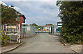
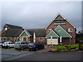
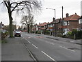
22 photos from this area
Area Information
Key information about the M33 5LS including its size, population, and administrative classification.
- Area Type
- Postcode
- Area Size
- 8623 m²
- Population
- 1755
- Population Density
- 6450 people/km²
House Prices in M33 5LS
31
Properties
£154,374
Average Sold Price
£66,000
Lowest Price
£243,000
Highest Price
Showing 31 properties
| Address | Type | Beds | Baths | Last Sale Price | Last Sale Date | |
|---|---|---|---|---|---|---|
| 61 Epping Drive, Sale, M33 5LS | house | - | - | £243,000 | Feb 2024 | |
| 65 Epping Drive, Sale, M33 5LS | Terraced | 2 | 1 | £225,000 | Jun 2023 | |
| 60 Epping Drive, Sale, M33 5LS | house | - | - | £240,000 | Nov 2021 | |
| 72A Epping Drive, Sale, M33 5LS | Detached | 3 | 1 | £159,995 | Apr 2014 | |
| 77 Epping Drive, Sale, M33 5LS | house | 3 | - | £135,000 | Aug 2010 | |
| 69 Epping Drive, Sale, M33 5LS | Terraced | - | - | £72,000 | Mar 2010 | |
| 67 Epping Drive, Sale, M33 5LS | house | - | - | £94,000 | Oct 2009 | |
| 73 Epping Drive, Sale, M33 5LS | Terraced | - | - | £66,000 | Sep 2003 | |
| 82 Epping Drive, Sale, M33 5LS | Terraced | 3 | 1 | - | - | |
| 64 Epping Drive, Sale, M33 5LS | Flat | - | - | - | - |
Page 1 of 4
Energy Efficiency in M33 5LS
Amenities
Schools
| Rank | School | Type | Entry gender | Ages |
|---|
Explore more schools in this area
Go to Schools tabDemographics
Household Size
Family (3-5 people)
most common
Accommodation Type
Houses
most common
Tenure
50
majority
Ethnic Group
White
most common
Religion
N/A
most common
Household Composition
N/A
most common
Age
47
median
Adults (30-64 years)
most common
Household Deprivation
N/A
with no deprivation
NS-SEC
26
in Lower managerial occupations
Explore more demographic insights in this area
Go to Demographics tabPlanning
Planning Constraints
- Flood RiskPremium
- Ramsar Wetland SitesPremium
- Area of Outstanding Natural BeautyPremium
- Protected Nature ReservePremium
- Protected WoodlandPremium