Area Overview for M32 9DT
Photos of M32 9DT
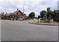
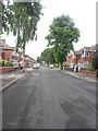
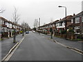
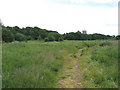
35 photos from this area
Area Information
Key information about the M32 9DT including its size, population, and administrative classification.
- Area Type
- Postcode
- Area Size
- 7518 m²
- Population
- 1606
- Population Density
- 6507 people/km²
House Prices in M32 9DT
18
Properties
£193,492
Average Sold Price
£43,000
Lowest Price
£315,000
Highest Price
Showing 18 properties
| Address | Type | Beds | Baths | Last Sale Price | Last Sale Date | |
|---|---|---|---|---|---|---|
| 66 Barkway Road, Stretford, M32 9DT | Semi-detached | 3 | 2 | £302,500 | Jan 2025 | |
| 57 Barkway Road, Stretford, M32 9DT | Semi-detached | 3 | 1 | £290,000 | Dec 2024 | |
| 55 Barkway Road, Stretford, M32 9DT | Semi-detached | 3 | 1 | £315,000 | Aug 2024 | |
| 60 Barkway Road, Stretford, M32 9DT | house | - | - | £240,000 | Dec 2020 | |
| 76 Barkway Road, Stretford, M32 9DT | house | - | - | £259,999 | Dec 2020 | |
| 64 Barkway Road, Stretford, M32 9DT | house | - | - | £250,000 | Apr 2019 | |
| 65 Barkway Road, Stretford, M32 9DT | Semi-detached | 3 | 2 | £159,950 | Dec 2013 | |
| 58 Barkway Road, Stretford, M32 9DT | house | - | - | £135,000 | Jan 2011 | |
| 67 Barkway Road, Stretford, M32 9DT | Semi-detached | - | - | £138,000 | May 2007 | |
| 68 Barkway Road, Stretford, M32 9DT | Semi-detached | - | - | £142,500 | Sep 2004 |
Page 1 of 2
Energy Efficiency in M32 9DT
Amenities
Schools
| Rank | School | Type | Entry gender | Ages |
|---|
Explore more schools in this area
Go to Schools tabDemographics
Household Size
Family (3-5 people)
most common
Accommodation Type
Houses
most common
Tenure
89
majority
Ethnic Group
White
most common
Religion
N/A
most common
Household Composition
N/A
most common
Age
47
median
Adults (30-64 years)
most common
Household Deprivation
N/A
with no deprivation
NS-SEC
38
in Lower managerial occupations
Explore more demographic insights in this area
Go to Demographics tabPlanning
Planning Constraints
- Flood RiskPremium
- Ramsar Wetland SitesPremium
- Area of Outstanding Natural BeautyPremium
- Protected Nature ReservePremium
- Protected WoodlandPremium