Area Overview for M32 8FE
Photos of M32 8FE
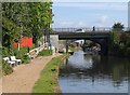
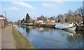

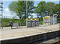


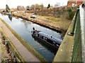
98 photos from this area
Area Information
Key information about the M32 8FE including its size, population, and administrative classification.
- Area Type
- Postcode
- Area Size
- 1.4 hectares
- Population
- 1746
- Population Density
- 7009 people/km²
House Prices in M32 8FE
34
Properties
£268,111
Average Sold Price
£93,000
Lowest Price
£525,000
Highest Price
Showing 34 properties
| Address | Type | Beds | Baths | Last Sale Price | Last Sale Date | |
|---|---|---|---|---|---|---|
| 51 Park Road, Stretford, M32 8FE | Semi-detached | 4 | 2 | £525,000 | May 2025 | |
| 21 Park Road, Stretford, M32 8FE | house | - | - | £411,500 | Apr 2024 | |
| 29 Park Road, Stretford, M32 8FE | house | - | - | £368,000 | Dec 2021 | |
| 41 Park Road, Stretford, M32 8FE | Semi-detached | 4 | 2 | £450,000 | Sep 2021 | |
| 37 Park Road, Stretford, M32 8FE | house | - | - | £480,000 | Jul 2021 | |
| 11 Park Road, Stretford, M32 8FE | house | 4 | 2 | £407,500 | Nov 2020 | |
| 39 Park Road, Stretford, M32 8FE | Semi-detached | - | - | £183,316 | Apr 2016 | |
| 61 Park Road, Stretford, M32 8FE | Semi-detached | 3 | - | £215,000 | Jan 2014 | |
| 33 Park Road, Stretford, M32 8FE | house | - | - | £215,000 | Aug 2012 | |
| 63 Park Road, Stretford, M32 8FE | Detached | 4 | 2 | £190,000 | Dec 2007 |
Page 1 of 4
Energy Efficiency in M32 8FE
Amenities
Schools
| Rank | School | Type | Entry gender | Ages |
|---|
Explore more schools in this area
Go to Schools tabDemographics
Household Size
Family (3-5 people)
most common
Accommodation Type
Houses
most common
Tenure
71
majority
Ethnic Group
White
most common
Religion
N/A
most common
Household Composition
N/A
most common
Age
47
median
Adults (30-64 years)
most common
Household Deprivation
N/A
with no deprivation
NS-SEC
33
in Lower managerial occupations
Explore more demographic insights in this area
Go to Demographics tabPlanning
Planning Constraints
- Flood RiskPremium
- Ramsar Wetland SitesPremium
- Area of Outstanding Natural BeautyPremium
- Protected Nature ReservePremium
- Protected WoodlandPremium