Area Overview for M32 8DN
Photos of M32 8DN
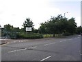
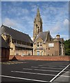
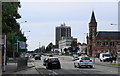
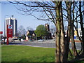


98 photos from this area
Area Information
Key information about the M32 8DN including its size, population, and administrative classification.
- Area Type
- Postcode
- Area Size
- 7545 m²
- Population
- 1724
- Population Density
- 7615 people/km²
House Prices in M32 8DN
33
Properties
£157,917
Average Sold Price
£57,000
Lowest Price
£250,000
Highest Price
Showing 33 properties
| Address | Type | Beds | Baths | Last Sale Price | Last Sale Date | |
|---|---|---|---|---|---|---|
| 163 Barton Road, Stretford, M32 8DN | Terraced | 5 | 1 | £225,000 | Nov 2019 | |
| 171 Barton Road, Stretford, M32 8DN | house | - | - | £250,000 | Apr 2017 | |
| 185 Barton Road, Stretford, M32 8DN | Semi-detached | 4 | - | £160,000 | Jun 2014 | |
| 167 Barton Road, Stretford, M32 8DN | house | - | - | £143,000 | Feb 2011 | |
| 165 Barton Road, Stretford, M32 8DN | Semi-detached | - | - | £165,000 | Nov 2010 | |
| 143A Barton Road, Stretford, M32 8DN | Flat | 2 | - | £190,000 | Apr 2008 | |
| 179 Barton Road, Stretford, M32 8DN | Terraced | - | - | £195,000 | Mar 2007 | |
| 181 Barton Road, Stretford, M32 8DN | Flat | 1 | 2 | £200,000 | Jan 2007 | |
| 161 Barton Road, Stretford, M32 8DN | Terraced | - | - | £110,000 | Jul 2003 | |
| 151 Barton Road, Stretford, M32 8DN | Unknown | - | - | £134,000 | Dec 2001 |
Page 1 of 4
Energy Efficiency in M32 8DN
Amenities
Schools
| Rank | School | Type | Entry gender | Ages |
|---|
Explore more schools in this area
Go to Schools tabDemographics
Household Size
Family (3-5 people)
most common
Accommodation Type
Houses
most common
Tenure
84
majority
Ethnic Group
White
most common
Religion
N/A
most common
Household Composition
N/A
most common
Age
47
median
Adults (30-64 years)
most common
Household Deprivation
N/A
with no deprivation
NS-SEC
36
in Lower managerial occupations
Explore more demographic insights in this area
Go to Demographics tabPlanning
Planning Constraints
- Flood RiskPremium
- Ramsar Wetland SitesPremium
- Area of Outstanding Natural BeautyPremium
- Protected Nature ReservePremium
- Protected WoodlandPremium