Area Overview for M32 0FA
Photos of M32 0FA
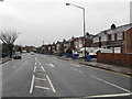
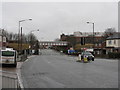
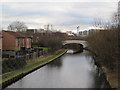
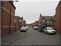
77 photos from this area
Area Information
Key information about the M32 0FA including its size, population, and administrative classification.
- Area Type
- Postcode
- Area Size
- 4620 m²
- Population
- 2328
- Population Density
- 7970 people/km²
House Prices in M32 0FA
34
Properties
£171,760
Average Sold Price
£28,000
Lowest Price
£264,000
Highest Price
Showing 34 properties
| Address | Type | Beds | Baths | Last Sale Price | Last Sale Date | |
|---|---|---|---|---|---|---|
| 4 Bowness Street, Stretford, M32 0FA | Terraced | 3 | 1 | £255,000 | Feb 2024 | |
| 10 Bowness Street, Stretford, M32 0FA | Terraced | 2 | 1 | £194,000 | Oct 2023 | |
| 30 Bowness Street, Stretford, M32 0FA | Terraced | 2 | 1 | £240,000 | Aug 2023 | |
| 6 Bowness Street, Stretford, M32 0FA | house | - | - | £190,000 | Aug 2023 | |
| 64 Bowness Street, Stretford, M32 0FA | Terraced | 3 | 1 | £212,500 | Jul 2023 | |
| 22 Bowness Street, Stretford, M32 0FA | house | - | - | £264,000 | Oct 2022 | |
| 36 Bowness Street, Stretford, M32 0FA | Retail | 2 | 1 | £246,000 | Apr 2022 | |
| 38 Bowness Street, Stretford, M32 0FA | Terraced | 2 | 1 | £213,000 | Jan 2022 | |
| 28 Bowness Street, Stretford, M32 0FA | Terraced | 2 | - | £225,000 | Sep 2021 | |
| 62 Bowness Street, Stretford, M32 0FA | Terraced | - | - | £215,000 | Mar 2021 |
Page 1 of 4
Energy Efficiency in M32 0FA
Amenities
Schools
| Rank | School | Type | Entry gender | Ages |
|---|
Explore more schools in this area
Go to Schools tabDemographics
Household Size
Family (3-5 people)
most common
Accommodation Type
Houses
most common
Tenure
65
majority
Ethnic Group
White
most common
Religion
N/A
most common
Household Composition
N/A
most common
Age
47
median
Adults (30-64 years)
most common
Household Deprivation
N/A
with no deprivation
NS-SEC
35
in Lower managerial occupations
Explore more demographic insights in this area
Go to Demographics tabPlanning
Planning Constraints
- Flood RiskPremium
- Ramsar Wetland SitesPremium
- Area of Outstanding Natural BeautyPremium
- Protected Nature ReservePremium
- Protected WoodlandPremium