Area Overview for M32 0EB
Photos of M32 0EB
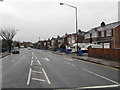
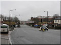
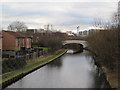
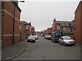
77 photos from this area
Area Information
Key information about the M32 0EB including its size, population, and administrative classification.
- Area Type
- Postcode
- Area Size
- 4780 m²
- Population
- 2328
- Population Density
- 7970 people/km²
House Prices in M32 0EB
31
Properties
£119,196
Average Sold Price
£31,000
Lowest Price
£200,000
Highest Price
Showing 31 properties
| Address | Type | Beds | Baths | Last Sale Price | Last Sale Date | |
|---|---|---|---|---|---|---|
| 29 Derwent Road, Stretford, M32 0EB | house | 3 | - | £200,000 | Jul 2024 | |
| 43 Derwent Road, Stretford, M32 0EB | house | - | - | £187,500 | Jun 2019 | |
| 55 Derwent Road, Stretford, M32 0EB | Terraced | 3 | 2 | £188,000 | May 2019 | |
| 49 Derwent Road, Stretford, M32 0EB | Terraced | 3 | 1 | £162,500 | Feb 2018 | |
| 53 Derwent Road, Stretford, M32 0EB | Terraced | 3 | 1 | £182,000 | Nov 2017 | |
| 27 Derwent Road, Stretford, M32 0EB | Terraced | 3 | 1 | £175,000 | Nov 2016 | |
| 21 Derwent Road, Stretford, M32 0EB | house | 3 | 1 | £155,000 | Dec 2015 | |
| 19 Derwent Road, Stretford, M32 0EB | house | 3 | - | £129,500 | Nov 2014 | |
| 45 Derwent Road, Stretford, M32 0EB | Terraced | 3 | 1 | £125,000 | Jun 2014 | |
| 7 Derwent Road, Stretford, M32 0EB | house | - | - | £112,500 | Sep 2013 |
Page 1 of 4
Energy Efficiency in M32 0EB
Amenities
Schools
| Rank | School | Type | Entry gender | Ages |
|---|
Explore more schools in this area
Go to Schools tabDemographics
Household Size
Family (3-5 people)
most common
Accommodation Type
Houses
most common
Tenure
65
majority
Ethnic Group
White
most common
Religion
N/A
most common
Household Composition
N/A
most common
Age
47
median
Adults (30-64 years)
most common
Household Deprivation
N/A
with no deprivation
NS-SEC
35
in Lower managerial occupations
Explore more demographic insights in this area
Go to Demographics tabPlanning
Planning Constraints
- Flood RiskPremium
- Ramsar Wetland SitesPremium
- Area of Outstanding Natural BeautyPremium
- Protected Nature ReservePremium
- Protected WoodlandPremium