Area Overview for M30 8AW
Photos of M30 8AW
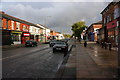
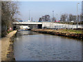
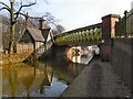

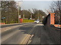
59 photos from this area
Area Information
Key information about the M30 8AW including its size, population, and administrative classification.
- Area Type
- Postcode
- Area Size
- 2.1 hectares
- Population
- 1349
- Population Density
- 7744 people/km²
House Prices in M30 8AW
79
Properties
£126,924
Average Sold Price
£33,000
Lowest Price
£360,000
Highest Price
Showing 79 properties
| Address | Type | Beds | Baths | Last Sale Price | Last Sale Date | |
|---|---|---|---|---|---|---|
| 98 Montonfields Road, Eccles, M30 8AW | Flat | 1 | 1 | £129,000 | Sep 2025 | |
| 67 Montonfields Road, Eccles, M30 8AW | Semi-detached | 3 | 2 | £360,000 | Feb 2025 | |
| 21 Montonfields Road, Eccles, M30 8AW | Terraced | 2 | 1 | £245,250 | Sep 2024 | |
| 57 Montonfields Road, Eccles, M30 8AW | Terraced | 2 | 1 | £240,000 | Aug 2024 | |
| 80 Montonfields Road, Eccles, M30 8AW | Flat | - | - | £112,000 | Dec 2023 | |
| 53 Montonfields Road, Eccles, M30 8AW | house | - | - | £90,000 | Oct 2023 | |
| 50 Montonfields Road, Eccles, M30 8AW | Detached | 3 | 2 | £350,000 | Jul 2023 | |
| 82 Montonfields Road, Eccles, M30 8AW | Flat | - | - | £125,000 | Jun 2023 | |
| 71 Montonfields Road, Eccles, M30 8AW | Terraced | 3 | 1 | £263,000 | Jun 2023 | |
| 74 Montonfields Road, Eccles, M30 8AW | Flat | 1 | 1 | £122,000 | Feb 2023 |
Page 1 of 8
Energy Efficiency in M30 8AW
Amenities
Schools
| Rank | School | Type | Entry gender | Ages |
|---|
Explore more schools in this area
Go to Schools tabDemographics
Household Size
One person
most common
Accommodation Type
Houses
most common
Tenure
55
majority
Ethnic Group
White
most common
Religion
N/A
most common
Household Composition
N/A
most common
Age
47
median
Adults (30-64 years)
most common
Household Deprivation
N/A
with no deprivation
NS-SEC
34
in Lower managerial occupations
Explore more demographic insights in this area
Go to Demographics tabPlanning
Planning Constraints
- Flood RiskPremium
- Ramsar Wetland SitesPremium
- Area of Outstanding Natural BeautyPremium
- Protected Nature ReservePremium
- Protected WoodlandPremium