Area Overview for M28 1LL
Photos of M28 1LL

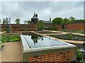

100 photos from this area
Area Information
Key information about the M28 1LL including its size, population, and administrative classification.
- Area Type
- Postcode
- Area Size
- 7.6 hectares
- Population
- 1419
- Population Density
- 3958 people/km²
House Prices in M28 1LL
10
Properties
£250,010
Average Sold Price
£139,000
Lowest Price
£411,000
Highest Price
Showing 10 properties
| Address | Type | Beds | Baths | Last Sale Price | Last Sale Date | |
|---|---|---|---|---|---|---|
| 223 Leigh Road, Worsley, M28 1LL | Detached | 2 | 2 | £265,000 | Aug 2025 | |
| Alderwood Boothsbank, Leigh Road, Worsley, M28 1LL | Detached | - | - | £411,000 | Sep 2021 | |
| 225 Leigh Road, Worsley, M28 1LL | Semi-detached | 4 | 1 | £139,000 | Aug 2012 | |
| 233 Leigh Road, Worsley, M28 1LL | Semi-detached | - | - | £185,049 | Feb 2007 | |
| 231 Leigh Road, Worsley, M28 1LL | house | - | - | £250,000 | Jun 2006 | |
| Boothsbank Farm, Leigh Road, Worsley, M28 1LL | Semi-detached | - | - | - | - | |
| Shaw Brook Booths Bank Farm, Leigh Road, Worsley, M28 1LL | Detached | - | - | - | - | |
| Boothsbank Farm Workshop, Leigh Road, Worsley, M28 1LL | Industrial | - | - | - | - | |
| 227 Leigh Road, Worsley, M28 1LL | Semi-detached | - | - | - | - | |
| 229 Leigh Road, Worsley, M28 1LL | house | - | - | - | - |
Energy Efficiency in M28 1LL
Amenities
Schools
| Rank | School | Type | Entry gender | Ages |
|---|
Explore more schools in this area
Go to Schools tabDemographics
Household Size
One person
most common
Accommodation Type
Houses
most common
Tenure
69
majority
Ethnic Group
White
most common
Religion
N/A
most common
Household Composition
N/A
most common
Age
47
median
Adults (30-64 years)
most common
Household Deprivation
N/A
with no deprivation
NS-SEC
34
in Lower managerial occupations
Explore more demographic insights in this area
Go to Demographics tabPlanning
Planning Constraints
- Flood RiskPremium
- Ramsar Wetland SitesPremium
- Area of Outstanding Natural BeautyPremium
- Protected Nature ReservePremium
- Protected WoodlandPremium