Area Overview for M28 1LE
Photos of M28 1LE
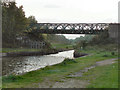
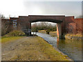
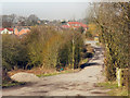
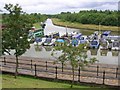

78 photos from this area
Area Information
Key information about the M28 1LE including its size, population, and administrative classification.
- Area Type
- Postcode
- Area Size
- 1.4 hectares
- Population
- 1511
- Population Density
- 172 people/km²
House Prices in M28 1LE
16
Properties
£307,236
Average Sold Price
£154,500
Lowest Price
£478,000
Highest Price
Showing 16 properties
| Address | Type | Beds | Baths | Last Sale Price | Last Sale Date | |
|---|---|---|---|---|---|---|
| 240 Leigh Road, Worsley, M28 1LE | Semi-detached | 3 | 1 | £470,000 | Oct 2024 | |
| 228 Leigh Road, Worsley, M28 1LE | house | - | - | £440,000 | Dec 2021 | |
| 224 Leigh Road, Worsley, M28 1LE | Semi-detached | 4 | 2 | £478,000 | Jun 2021 | |
| 220 Leigh Road, Worsley, M28 1LE | Bungalow | 2 | - | £287,625 | Apr 2021 | |
| 232 Leigh Road, Worsley, M28 1LE | house | - | - | £290,000 | Jun 2020 | |
| 222 Leigh Road, Worsley, M28 1LE | Detached | 3 | 1 | £220,000 | Feb 2010 | |
| 238 Leigh Road, Worsley, M28 1LE | house | - | - | £205,000 | Aug 2009 | |
| 236 Leigh Road, Worsley, M28 1LE | Semi-detached | 4 | 2 | £220,000 | Dec 2005 | |
| 230 Leigh Road, Worsley, M28 1LE | house | 3 | - | £154,500 | Apr 2003 | |
| 248 Leigh Road, Worsley, M28 1LE | Detached | - | - | - | - |
Page 1 of 2
Energy Efficiency in M28 1LE
Amenities
Schools
| Rank | School | Type | Entry gender | Ages |
|---|
Explore more schools in this area
Go to Schools tabDemographics
Household Size
Two person
most common
Accommodation Type
Houses
most common
Tenure
93
majority
Ethnic Group
White
most common
Religion
N/A
most common
Household Composition
N/A
most common
Age
47
median
Adults (30-64 years)
most common
Household Deprivation
N/A
with no deprivation
NS-SEC
52
in Lower managerial occupations
Explore more demographic insights in this area
Go to Demographics tabPlanning
Planning Constraints
- Flood RiskPremium
- Ramsar Wetland SitesPremium
- Area of Outstanding Natural BeautyPremium
- Protected Nature ReservePremium
- Protected WoodlandPremium