Area Overview for M27 9UR
Photos of M27 9UR
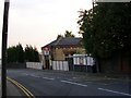
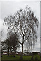
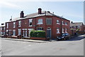
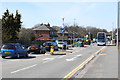

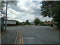
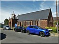
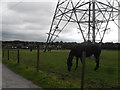
26 photos from this area
Area Information
Key information about the M27 9UR including its size, population, and administrative classification.
- Area Type
- Postcode
- Area Size
- 5316 m²
- Population
- 1433
- Population Density
- 4163 people/km²
House Prices in M27 9UR
30
Properties
£125,908
Average Sold Price
£37,000
Lowest Price
£375,000
Highest Price
Showing 30 properties
| Address | Type | Beds | Baths | Last Sale Price | Last Sale Date | |
|---|---|---|---|---|---|---|
| 89 Charles Street, Swinton, M27 9UR | Terraced | 2 | 1 | £190,000 | Jul 2025 | |
| 101 Charles Street, Swinton, M27 9UR | Semi-detached | 4 | 2 | £375,000 | Feb 2023 | |
| 61 Charles Street, Swinton, M27 9UR | house | 2 | - | £165,000 | Dec 2022 | |
| 69 Charles Street, Swinton, M27 9UR | Terraced | 2 | 1 | £180,000 | Oct 2022 | |
| 65 Charles Street, Swinton, M27 9UR | Terraced | 2 | 1 | £195,000 | Oct 2021 | |
| 79 Charles Street, Swinton, M27 9UR | house | 3 | - | £172,500 | Jul 2021 | |
| 97 Charles Street, Swinton, M27 9UR | Terraced | 2 | 1 | £131,000 | Apr 2021 | |
| 77 Charles Street, Swinton, M27 9UR | Terraced | 2 | - | £137,950 | Dec 2019 | |
| 49 Charles Street, Swinton, M27 9UR | Terraced | 2 | 1 | £120,000 | Mar 2018 | |
| 51 Charles Street, Swinton, M27 9UR | house | - | - | £111,000 | Jun 2017 |
Page 1 of 3
Energy Efficiency in M27 9UR
Amenities
Schools
| Rank | School | Type | Entry gender | Ages |
|---|
Explore more schools in this area
Go to Schools tabDemographics
Household Size
Two person
most common
Accommodation Type
Houses
most common
Tenure
77
majority
Ethnic Group
White
most common
Religion
N/A
most common
Household Composition
N/A
most common
Age
47
median
Adults (30-64 years)
most common
Household Deprivation
N/A
with no deprivation
NS-SEC
29
in Lower managerial occupations
Explore more demographic insights in this area
Go to Demographics tabPlanning
Planning Constraints
- Flood RiskPremium
- Ramsar Wetland SitesPremium
- Area of Outstanding Natural BeautyPremium
- Protected Nature ReservePremium
- Protected WoodlandPremium