Area Overview for M27 9RY
Photos of M27 9RY


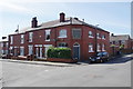
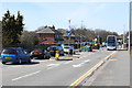

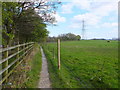


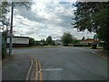

26 photos from this area
Area Information
Key information about the M27 9RY including its size, population, and administrative classification.
- Area Type
- Postcode
- Area Size
- 4869 m²
- Population
- 1433
- Population Density
- 4163 people/km²
House Prices in M27 9RY
19
Properties
£115,000
Average Sold Price
£245
Lowest Price
£220,000
Highest Price
Showing 19 properties
| Address | Type | Beds | Baths | Last Sale Price | Last Sale Date | |
|---|---|---|---|---|---|---|
| 98 Moss Lane, Swinton, M27 9RY | Terraced | 4 | 1 | £220,000 | Feb 2025 | |
| 102 Moss Lane, Swinton, M27 9RY | house | - | - | £100,000 | May 2023 | |
| 128 Moss Lane, Swinton, M27 9RY | Semi-detached | 3 | 2 | £219,000 | Nov 2020 | |
| 124 Moss Lane, Swinton, M27 9RY | Terraced | 2 | 1 | £155,000 | Aug 2020 | |
| 108 Moss Lane, Swinton, M27 9RY | Terraced | 2 | 1 | £122,500 | Apr 2018 | |
| 126 Moss Lane, Swinton, M27 9RY | house | 2 | - | £245 | Jan 2018 | |
| 118 Moss Lane, Swinton, M27 9RY | Terraced | 2 | 1 | £120,000 | Oct 2017 | |
| 92 Moss Lane, Swinton, M27 9RY | Terraced | 2 | - | £162,500 | Nov 2011 | |
| 100 Moss Lane, Swinton, M27 9RY | house | - | - | £80,000 | Jan 2011 | |
| 130 Moss Lane, Swinton, M27 9RY | Semi-detached | 4 | 3 | £190,000 | Nov 2005 |
Page 1 of 2
Energy Efficiency in M27 9RY
Amenities
Schools
| Rank | School | Type | Entry gender | Ages |
|---|
Explore more schools in this area
Go to Schools tabDemographics
Household Size
Two person
most common
Accommodation Type
Houses
most common
Tenure
77
majority
Ethnic Group
White
most common
Religion
N/A
most common
Household Composition
N/A
most common
Age
47
median
Adults (30-64 years)
most common
Household Deprivation
N/A
with no deprivation
NS-SEC
29
in Lower managerial occupations
Explore more demographic insights in this area
Go to Demographics tabPlanning
Planning Constraints
- Flood RiskPremium
- Ramsar Wetland SitesPremium
- Area of Outstanding Natural BeautyPremium
- Protected Nature ReservePremium
- Protected WoodlandPremium