Area Overview for M27 6DH
Photos of M27 6DH
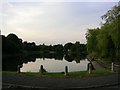
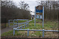
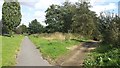
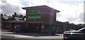
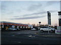
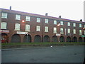
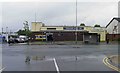
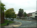
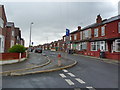
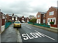
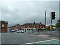
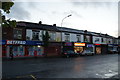
22 photos from this area
Area Information
Key information about the M27 6DH including its size, population, and administrative classification.
- Area Type
- Postcode
- Area Size
- 1.2 hectares
- Population
- 1759
- Population Density
- 4379 people/km²
House Prices in M27 6DH
43
Properties
£105,727
Average Sold Price
£26,000
Lowest Price
£165,000
Highest Price
Showing 43 properties
| Address | Type | Beds | Baths | Last Sale Price | Last Sale Date | |
|---|---|---|---|---|---|---|
| 46 Coronation Street, Swinton, M27 6DH | Semi-detached | 2 | 1 | £157,000 | Jan 2024 | |
| 48 Coronation Street, Swinton, M27 6DH | house | - | - | £150,000 | Apr 2023 | |
| 73 Coronation Street, Swinton, M27 6DH | house | - | - | £165,000 | Mar 2021 | |
| 30 Coronation Street, Swinton, M27 6DH | Terraced | 3 | 1 | £124,000 | Sep 2019 | |
| 62 Coronation Street, Swinton, M27 6DH | Semi-detached | 2 | 1 | £108,000 | May 2019 | |
| 28 Coronation Street, Swinton, M27 6DH | Terraced | 3 | 1 | £103,000 | May 2018 | |
| 24 Coronation Street, Swinton, M27 6DH | Semi-detached | 2 | - | £90,000 | Mar 2015 | |
| 38 Coronation Street, Swinton, M27 6DH | Semi-detached | - | - | £95,270 | Dec 2007 | |
| 26 Coronation Street, Swinton, M27 6DH | Terraced | - | - | £39,000 | Oct 2001 | |
| 75 Coronation Street, Swinton, M27 6DH | Terraced | - | - | £26,000 | Nov 1999 |
Page 1 of 5
Energy Efficiency in M27 6DH
Amenities
Schools
| Rank | School | Type | Entry gender | Ages |
|---|
Explore more schools in this area
Go to Schools tabDemographics
Household Size
One person
most common
Accommodation Type
Houses
most common
Tenure
39
majority
Ethnic Group
White
most common
Religion
N/A
most common
Household Composition
N/A
most common
Age
47
median
Adults (30-64 years)
most common
Household Deprivation
N/A
with no deprivation
NS-SEC
22
in Lower managerial occupations
Explore more demographic insights in this area
Go to Demographics tabPlanning
Planning Constraints
- Flood RiskPremium
- Ramsar Wetland SitesPremium
- Area of Outstanding Natural BeautyPremium
- Protected Nature ReservePremium
- Protected WoodlandPremium