Area Overview for M26 4EZ
Photos of M26 4EZ

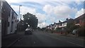
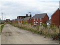
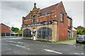
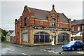
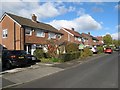
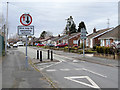
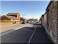
78 photos from this area
Area Information
Key information about the M26 4EZ including its size, population, and administrative classification.
- Area Type
- Postcode
- Area Size
- 5332 m²
- Population
- 1485
- Population Density
- 9477 people/km²
House Prices in M26 4EZ
32
Properties
£92,758
Average Sold Price
£24,000
Lowest Price
£160,200
Highest Price
Showing 32 properties
| Address | Type | Beds | Baths | Last Sale Price | Last Sale Date | |
|---|---|---|---|---|---|---|
| 265 Ainsworth Road, Radcliffe, M26 4EZ | Terraced | 2 | 1 | £138,000 | Dec 2025 | |
| 289 Ainsworth Road, Radcliffe, M26 4EZ | Terraced | 2 | 1 | £160,200 | Jun 2024 | |
| 269 Ainsworth Road, Radcliffe, M26 4EZ | Terraced | 2 | 1 | £143,000 | Sep 2022 | |
| 275 Ainsworth Road, Radcliffe, M26 4EZ | Terraced | 3 | 1 | £140,000 | Mar 2022 | |
| 283 Ainsworth Road, Radcliffe, M26 4EZ | Terraced | 2 | 1 | £99,950 | Sep 2020 | |
| 315B Ainsworth Road, Radcliffe, M26 4EZ | Terraced | 3 | 1 | £100,000 | Mar 2020 | |
| 285 Ainsworth Road, Radcliffe, M26 4EZ | Terraced | 2 | 1 | £63,500 | Feb 2018 | |
| 295 Ainsworth Road, Radcliffe, M26 4EZ | Terraced | 2 | 1 | £76,000 | Sep 2017 | |
| 305B Ainsworth Road, Radcliffe, M26 4EZ | Terraced | 2 | 1 | £63,500 | Aug 2016 | |
| 307B Ainsworth Road, Radcliffe, M26 4EZ | house | - | - | £87,000 | Oct 2015 |
Page 1 of 4
Energy Efficiency in M26 4EZ
Amenities
Schools
| Rank | School | Type | Entry gender | Ages |
|---|
Explore more schools in this area
Go to Schools tabDemographics
Household Size
One person
most common
Accommodation Type
Houses
most common
Tenure
51
majority
Ethnic Group
White
most common
Religion
N/A
most common
Household Composition
N/A
most common
Age
47
median
Adults (30-64 years)
most common
Household Deprivation
N/A
with no deprivation
NS-SEC
20
in Lower managerial occupations
Explore more demographic insights in this area
Go to Demographics tabPlanning
Planning Constraints
- Flood RiskPremium
- Ramsar Wetland SitesPremium
- Area of Outstanding Natural BeautyPremium
- Protected Nature ReservePremium
- Protected WoodlandPremium