Area Overview for M26 4EY
Photos of M26 4EY

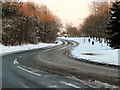
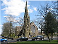


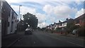
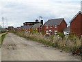
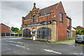
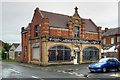
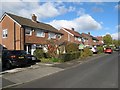
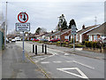
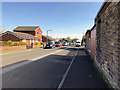
78 photos from this area
Area Information
Key information about the M26 4EY including its size, population, and administrative classification.
- Area Type
- Postcode
- Area Size
- 6974 m²
- Population
- 1485
- Population Density
- 9477 people/km²
House Prices in M26 4EY
29
Properties
£88,933
Average Sold Price
£26,500
Lowest Price
£155,000
Highest Price
Showing 29 properties
| Address | Type | Beds | Baths | Last Sale Price | Last Sale Date | |
|---|---|---|---|---|---|---|
| 310 Ainsworth Road, Radcliffe, M26 4EY | Terraced | 2 | 2 | £120,000 | Oct 2025 | |
| 294 Ainsworth Road, Radcliffe, M26 4EY | Terraced | 2 | 1 | £145,760 | May 2025 | |
| 280 Ainsworth Road, Radcliffe, M26 4EY | Terraced | 3 | 1 | £155,000 | Mar 2025 | |
| 274 Ainsworth Road, Radcliffe, M26 4EY | Terraced | 2 | 1 | £115,000 | Feb 2025 | |
| 258 Ainsworth Road, Radcliffe, M26 4EY | Terraced | 3 | 2 | £110,000 | Dec 2024 | |
| 312 Ainsworth Road, Radcliffe, M26 4EY | Terraced | 2 | 1 | £120,000 | Apr 2024 | |
| 284 Ainsworth Road, Radcliffe, M26 4EY | Terraced | 2 | 1 | £115,000 | Feb 2020 | |
| 288 Ainsworth Road, Radcliffe, M26 4EY | Terraced | 2 | 2 | £105,000 | Aug 2019 | |
| 292 Ainsworth Road, Radcliffe, M26 4EY | Terraced | 3 | 1 | £80,000 | Feb 2019 | |
| 270 Ainsworth Road, Radcliffe, M26 4EY | Terraced | 2 | 1 | £95,000 | May 2018 |
Page 1 of 3
Energy Efficiency in M26 4EY
Amenities
Schools
| Rank | School | Type | Entry gender | Ages |
|---|
Explore more schools in this area
Go to Schools tabDemographics
Household Size
One person
most common
Accommodation Type
Houses
most common
Tenure
51
majority
Ethnic Group
White
most common
Religion
N/A
most common
Household Composition
N/A
most common
Age
47
median
Adults (30-64 years)
most common
Household Deprivation
N/A
with no deprivation
NS-SEC
20
in Lower managerial occupations
Explore more demographic insights in this area
Go to Demographics tabPlanning
Planning Constraints
- Flood RiskPremium
- Ramsar Wetland SitesPremium
- Area of Outstanding Natural BeautyPremium
- Protected Nature ReservePremium
- Protected WoodlandPremium