Area Overview for M26 3TF
Photos of M26 3TF
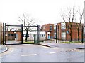
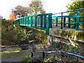


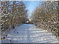
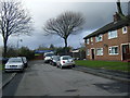
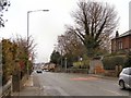
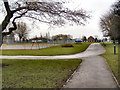
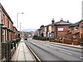
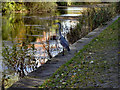
100 photos from this area
Area Information
Key information about the M26 3TF including its size, population, and administrative classification.
- Area Type
- Postcode
- Area Size
- 7673 m²
- Population
- 1501
- Population Density
- 1445 people/km²
House Prices in M26 3TF
10
Properties
£147,570
Average Sold Price
£45,850
Lowest Price
£330,000
Highest Price
Showing 10 properties
| Address | Type | Beds | Baths | Last Sale Price | Last Sale Date | |
|---|---|---|---|---|---|---|
| 5 Pitt Street, Radcliffe, M26 3TF | Bungalow | - | - | £330,000 | Jul 2022 | |
| 18 Pitt Street, Radcliffe, M26 3TF | Bungalow | - | - | £144,000 | Aug 2014 | |
| 14 Pitt Street, Radcliffe, M26 3TF | Semi-detached | 3 | 2 | £155,000 | Aug 2005 | |
| 1 Pitt Street, Radcliffe, M26 3TF | Semi-detached | - | - | £63,000 | Aug 1998 | |
| 3 Pitt Street, Radcliffe, M26 3TF | Land | - | - | £45,850 | Oct 1997 | |
| 11 Pitt Street, Radcliffe, M26 3TF | Detached | 3 | 2 | - | - | |
| Frank Ratcliffe Roofing Centre, Pitt Street, Radcliffe, M26 3TF | Industrial | - | - | - | - | |
| 15 Pitt Street, Radcliffe, M26 3TF | Semi-detached | - | - | - | - | |
| 16 Pitt Street, Radcliffe, M26 3TF | Detached | - | - | - | - | |
| 20 Pitt Street, Radcliffe, M26 3TF | Detached | - | - | - | - |
Energy Efficiency in M26 3TF
Amenities
Schools
| Rank | School | Type | Entry gender | Ages |
|---|
Explore more schools in this area
Go to Schools tabDemographics
Household Size
Two person
most common
Accommodation Type
Houses
most common
Tenure
89
majority
Ethnic Group
White
most common
Religion
N/A
most common
Household Composition
N/A
most common
Age
47
median
Adults (30-64 years)
most common
Household Deprivation
N/A
with no deprivation
NS-SEC
31
in Lower managerial occupations
Explore more demographic insights in this area
Go to Demographics tabPlanning
Planning Constraints
- Flood RiskPremium
- Ramsar Wetland SitesPremium
- Area of Outstanding Natural BeautyPremium
- Protected Nature ReservePremium
- Protected WoodlandPremium