Area Overview for M26 3GQ
Photos of M26 3GQ
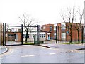
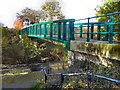
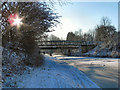
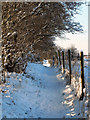
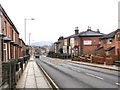
100 photos from this area
Area Information
Key information about the M26 3GQ including its size, population, and administrative classification.
- Area Type
- Postcode
- Area Size
- 4320 m²
- Population
- 1586
- Population Density
- 5730 people/km²
House Prices in M26 3GQ
23
Properties
£65,153
Average Sold Price
£22,500
Lowest Price
£117,500
Highest Price
Showing 23 properties
| Address | Type | Beds | Baths | Last Sale Price | Last Sale Date | |
|---|---|---|---|---|---|---|
| 362 Bolton Road, Radcliffe, M26 3GQ | house | 3 | - | £117,500 | Dec 2022 | |
| 384 Bolton Road, Radcliffe, M26 3GQ | Terraced | 2 | 1 | £89,000 | Mar 2021 | |
| 378 Bolton Road, Radcliffe, M26 3GQ | Terraced | 2 | 1 | £108,000 | Jun 2020 | |
| 390 Bolton Road, Radcliffe, M26 3GQ | Terraced | 3 | - | £85,000 | Mar 2018 | |
| 368 Bolton Road, Radcliffe, M26 3GQ | Terraced | 2 | 1 | £75,000 | Oct 2017 | |
| 414 Bolton Road, Radcliffe, M26 3GQ | Detached | 3 | 1 | £96,000 | Dec 2015 | |
| 382 Bolton Road, Radcliffe, M26 3GQ | house | 2 | - | £70,000 | Sep 2015 | |
| 376 Bolton Road, Radcliffe, M26 3GQ | house | - | - | £69,000 | Mar 2015 | |
| 372 Bolton Road, Radcliffe, M26 3GQ | house | - | - | £76,000 | Apr 2007 | |
| 364 Bolton Road, Radcliffe, M26 3GQ | Terraced | 2 | 1 | £74,995 | Jun 2004 |
Page 1 of 3
Energy Efficiency in M26 3GQ
Amenities
Schools
| Rank | School | Type | Entry gender | Ages |
|---|
Explore more schools in this area
Go to Schools tabDemographics
Household Size
Family (3-5 people)
most common
Accommodation Type
Houses
most common
Tenure
59
majority
Ethnic Group
White
most common
Religion
N/A
most common
Household Composition
N/A
most common
Age
47
median
Adults (30-64 years)
most common
Household Deprivation
N/A
with no deprivation
NS-SEC
23
in Lower managerial occupations
Explore more demographic insights in this area
Go to Demographics tabPlanning
Planning Constraints
- Flood RiskPremium
- Ramsar Wetland SitesPremium
- Area of Outstanding Natural BeautyPremium
- Protected Nature ReservePremium
- Protected WoodlandPremium