Area Overview for M25 9GZ
Photos of M25 9GZ
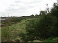
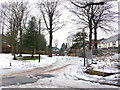
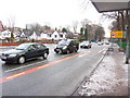
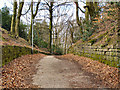
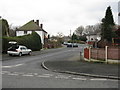
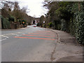
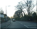
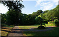
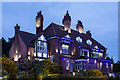
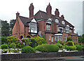
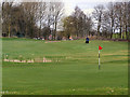
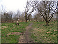
33 photos from this area
Area Information
Key information about the M25 9GZ including its size, population, and administrative classification.
- Area Type
- Postcode
- Area Size
- 3349 m²
- Population
- 1357
- Population Density
- 5398 people/km²
House Prices in M25 9GZ
10
Properties
£221,842
Average Sold Price
£77,450
Lowest Price
£325,000
Highest Price
Showing 10 properties
| Address | Type | Beds | Baths | Last Sale Price | Last Sale Date | |
|---|---|---|---|---|---|---|
| 18 Agecroft Road East, Prestwich, M25 9GZ | Semi-detached | 3 | 2 | £325,000 | Sep 2024 | |
| 16 Agecroft Road East, Prestwich, M25 9GZ | Semi-detached | 3 | 1 | £285,400 | May 2021 | |
| 12 Agecroft Road East, Prestwich, M25 9GZ | Semi-detached | 3 | 1 | £195,000 | Sep 2019 | |
| 8 Agecroft Road East, Prestwich, M25 9GZ | Detached | 3 | 1 | £232,500 | Jun 2018 | |
| 24 Agecroft Road East, Prestwich, M25 9GZ | house | - | - | £215,700 | Dec 2012 | |
| 20 Agecroft Road East, Prestwich, M25 9GZ | Semi-detached | - | - | £77,450 | Jul 1998 | |
| 22 Agecroft Road East, Prestwich, M25 9GZ | Semi-detached | 3 | 1 | - | - | |
| 14 Agecroft Road East, Prestwich, M25 9GZ | Semi-detached | 3 | 1 | - | - | |
| 6 Agecroft Road East, Prestwich, M25 9GZ | Flat | - | - | - | - | |
| 10 Agecroft Road East, Prestwich, M25 9GZ | Semi-detached | - | - | - | - |
Energy Efficiency in M25 9GZ
Amenities
Schools
| Rank | School | Type | Entry gender | Ages |
|---|
Explore more schools in this area
Go to Schools tabDemographics
Household Size
Family (3-5 people)
most common
Accommodation Type
Houses
most common
Tenure
92
majority
Ethnic Group
White
most common
Religion
N/A
most common
Household Composition
N/A
most common
Age
47
median
Adults (30-64 years)
most common
Household Deprivation
N/A
with no deprivation
NS-SEC
47
in Lower managerial occupations
Explore more demographic insights in this area
Go to Demographics tabPlanning
Planning Constraints
- Flood RiskPremium
- Ramsar Wetland SitesPremium
- Area of Outstanding Natural BeautyPremium
- Protected Nature ReservePremium
- Protected WoodlandPremium