Area Overview for M25 1DA
Photos of M25 1DA
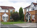
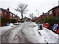
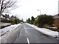
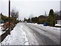
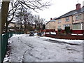

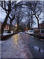
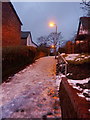
80 photos from this area
Area Information
Key information about the M25 1DA including its size, population, and administrative classification.
- Area Type
- Postcode
- Area Size
- 5774 m²
- Population
- 1619
- Population Density
- 5158 people/km²
House Prices in M25 1DA
14
Properties
£177,381
Average Sold Price
£48,000
Lowest Price
£342,700
Highest Price
Showing 14 properties
| Address | Type | Beds | Baths | Last Sale Price | Last Sale Date | |
|---|---|---|---|---|---|---|
| 129 Rectory Lane, Prestwich, M25 1DA | house | 3 | - | £342,700 | Apr 2021 | |
| 125 Rectory Lane, Prestwich, M25 1DA | Semi-detached | 3 | 1 | £201,275 | Jun 2017 | |
| 111 Rectory Lane, Prestwich, M25 1DA | Semi-detached | 3 | 1 | £222,000 | Aug 2015 | |
| 115 Rectory Lane, Prestwich, M25 1DA | house | - | - | £150,000 | Jun 2015 | |
| 117 Rectory Lane, Prestwich, M25 1DA | house | - | - | £152,500 | Sep 2013 | |
| 131 Rectory Lane, Prestwich, M25 1DA | Semi-detached | 3 | - | £179,950 | Sep 2013 | |
| 135 RECTORY LANE, Prestwich, M25 1DA | Semi-detached | - | - | £205,000 | Feb 2006 | |
| 137 Rectory Lane, Prestwich, M25 1DA | Semi-detached | 3 | 1 | £95,000 | Feb 2003 | |
| 133 Rectory Lane, Prestwich, M25 1DA | Semi-detached | - | - | £48,000 | Nov 1998 | |
| 119 Rectory Lane, Prestwich, M25 1DA | Semi-detached | - | - | - | - |
Page 1 of 2
Energy Efficiency in M25 1DA
Amenities
Schools
| Rank | School | Type | Entry gender | Ages |
|---|
Explore more schools in this area
Go to Schools tabDemographics
Household Size
One person
most common
Accommodation Type
Houses
most common
Tenure
75
majority
Ethnic Group
White
most common
Religion
N/A
most common
Household Composition
N/A
most common
Age
47
median
Adults (30-64 years)
most common
Household Deprivation
N/A
with no deprivation
NS-SEC
41
in Lower managerial occupations
Explore more demographic insights in this area
Go to Demographics tabPlanning
Planning Constraints
- Flood RiskPremium
- Ramsar Wetland SitesPremium
- Area of Outstanding Natural BeautyPremium
- Protected Nature ReservePremium
- Protected WoodlandPremium