Area Overview for M24 1JS
Photos of M24 1JS


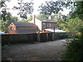


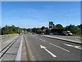

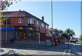
24 photos from this area
Area Information
Key information about the M24 1JS including its size, population, and administrative classification.
- Area Type
- Postcode
- Area Size
- 7599 m²
- Population
- 1548
- Population Density
- 2778 people/km²
House Prices in M24 1JS
7
Properties
£273,499
Average Sold Price
£152,500
Lowest Price
£350,000
Highest Price
Showing 7 properties
| Address | Type | Beds | Baths | Last Sale Price | Last Sale Date | |
|---|---|---|---|---|---|---|
| 254 Manchester New Road, Middleton, M24 1JS | house | - | - | £340,000 | Feb 2020 | |
| 256 Manchester New Road, Middleton, M24 1JS | house | - | - | £275,000 | Dec 2015 | |
| 258 Manchester New Road, Middleton, M24 1JS | Detached | 4 | 2 | £350,000 | Oct 2013 | |
| 262 Manchester New Road, Middleton, M24 1JS | Detached | 4 | 2 | £249,995 | Dec 2002 | |
| 250 Manchester New Road, Middleton, M24 1JS | Detached | - | - | £152,500 | Aug 2001 | |
| 252 Manchester New Road, Middleton, M24 1JS | house | - | - | - | - | |
| 260 Manchester New Road, Middleton, M24 1JS | house | - | - | - | - |
Energy Efficiency in M24 1JS
Amenities
Schools
| Rank | School | Type | Entry gender | Ages |
|---|
Explore more schools in this area
Go to Schools tabDemographics
Household Size
Family (3-5 people)
most common
Accommodation Type
Houses
most common
Tenure
94
majority
Ethnic Group
White
most common
Religion
N/A
most common
Household Composition
N/A
most common
Age
47
median
Adults (30-64 years)
most common
Household Deprivation
N/A
with no deprivation
NS-SEC
49
in Lower managerial occupations
Explore more demographic insights in this area
Go to Demographics tabPlanning
Planning Constraints
- Flood RiskPremium
- Ramsar Wetland SitesPremium
- Area of Outstanding Natural BeautyPremium
- Protected Nature ReservePremium
- Protected WoodlandPremium