Area Overview for M24 1PB
Photos of M24 1PB
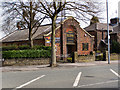


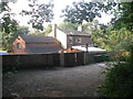
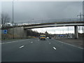

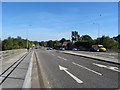

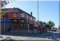
24 photos from this area
Area Information
Key information about the M24 1PB including its size, population, and administrative classification.
- Area Type
- Postcode
- Area Size
- 1.8 hectares
- Population
- 1548
- Population Density
- 2778 people/km²
House Prices in M24 1PB
14
Properties
£339,661
Average Sold Price
£150,000
Lowest Price
£550,000
Highest Price
Showing 14 properties
| Address | Type | Beds | Baths | Last Sale Price | Last Sale Date | |
|---|---|---|---|---|---|---|
| 50 Mainway, Middleton, M24 1PB | house | - | - | £550,000 | Apr 2022 | |
| 40 Mainway, Middleton, M24 1PB | house | - | - | £510,000 | Mar 2022 | |
| 44 Mainway, Middleton, M24 1PB | Detached | 8 | 3 | £490,000 | May 2021 | |
| 52 Mainway, Middleton, M24 1PB | house | - | - | £350,000 | Apr 2021 | |
| 34 Mainway, Middleton, M24 1PB | Semi-detached | 4 | 1 | £272,000 | Oct 2017 | |
| 56 Mainway, Middleton, M24 1PB | house | - | - | £244,000 | Jul 2013 | |
| 48 Mainway, Middleton, M24 1PB | house | - | - | £249,950 | Mar 2010 | |
| 54 Mainway, Middleton, M24 1PB | Semi-detached | - | - | £241,000 | Aug 2006 | |
| 32 Mainway, Middleton, M24 1PB | Semi-detached | - | - | £150,000 | Oct 2005 | |
| 30 Mainway, Middleton, M24 1PB | Semi-detached | - | - | - | - |
Page 1 of 2
Energy Efficiency in M24 1PB
Amenities
Schools
| Rank | School | Type | Entry gender | Ages |
|---|
Explore more schools in this area
Go to Schools tabDemographics
Household Size
Family (3-5 people)
most common
Accommodation Type
Houses
most common
Tenure
94
majority
Ethnic Group
White
most common
Religion
N/A
most common
Household Composition
N/A
most common
Age
47
median
Adults (30-64 years)
most common
Household Deprivation
N/A
with no deprivation
NS-SEC
49
in Lower managerial occupations
Explore more demographic insights in this area
Go to Demographics tabPlanning
Planning Constraints
- Flood RiskPremium
- Ramsar Wetland SitesPremium
- Area of Outstanding Natural BeautyPremium
- Protected Nature ReservePremium
- Protected WoodlandPremium