Area Overview for M22 4NQ
Photos of M22 4NQ

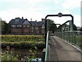
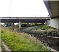
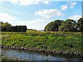
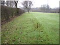
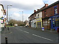
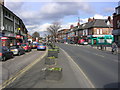
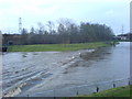

78 photos from this area
Area Information
Key information about the M22 4NQ including its size, population, and administrative classification.
- Area Type
- Postcode
- Area Size
- 49.2 hectares
- Population
- 1736
- Population Density
- 1486 people/km²
House Prices in M22 4NQ
17
Properties
£430,625
Average Sold Price
£142,500
Lowest Price
£840,000
Highest Price
Showing 17 properties
| Address | Type | Beds | Baths | Last Sale Price | Last Sale Date | |
|---|---|---|---|---|---|---|
| Rectory Cottage, Ford Lane, Manchester, M22 4NQ | house | - | - | £840,000 | Jul 2022 | |
| Axford, Ford Lane, Manchester, M22 4NQ | Semi-detached | 2 | - | £245,000 | Aug 2020 | |
| Church Villa, Ford Lane, Manchester, M22 4NQ | Semi-detached | 4 | - | £495,000 | May 2018 | |
| Norden, Ford Lane, Manchester, M22 4NQ | Mobile Home | 2 | 2 | £142,500 | Apr 2012 | |
| Ford Cottage, Didsbury Golf Club, Ford Lane, Manchester, M22 4NQ | Bungalow | 2 | - | - | - | |
| Northern House, Ford Lane, Manchester, M22 4NQ | Detached | 4 | 2 | - | - | |
| Maygem, Ford Lane, Manchester, M22 4NQ | Detached | 3 | 1 | - | - | |
| Churchgate, Ford Lane, Manchester, M22 4NQ | house | - | - | - | - | |
| Cromwell Cottage, Ford Lane, Manchester, M22 4NQ | Terraced | 2 | 2 | - | - | |
| Dene House, Ford Lane, Manchester, M22 4NQ | Detached | - | - | - | - |
Page 1 of 2
Energy Efficiency in M22 4NQ
Amenities
Schools
| Rank | School | Type | Entry gender | Ages |
|---|
Explore more schools in this area
Go to Schools tabDemographics
Household Size
One person
most common
Accommodation Type
Houses
most common
Tenure
41
majority
Ethnic Group
White
most common
Religion
N/A
most common
Household Composition
N/A
most common
Age
47
median
Adults (30-64 years)
most common
Household Deprivation
N/A
with no deprivation
NS-SEC
30
in Lower managerial occupations
Explore more demographic insights in this area
Go to Demographics tabPlanning
Planning Constraints
- Flood RiskPremium
- Ramsar Wetland SitesPremium
- Area of Outstanding Natural BeautyPremium
- Protected Nature ReservePremium
- Protected WoodlandPremium