Area Overview for M21 0ZH
Photos of M21 0ZH
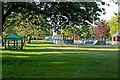
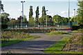
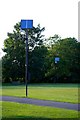
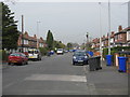
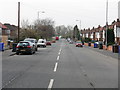
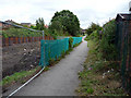
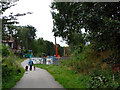
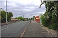
100 photos from this area
Area Information
Key information about the M21 0ZH including its size, population, and administrative classification.
- Area Type
- Postcode
- Area Size
- 6284 m²
- Population
- 1482
- Population Density
- 5726 people/km²
House Prices in M21 0ZH
16
Properties
£185,832
Average Sold Price
£70,000
Lowest Price
£360,000
Highest Price
Showing 16 properties
| Address | Type | Beds | Baths | Last Sale Price | Last Sale Date | |
|---|---|---|---|---|---|---|
| 58 Egerton Road South, Manchester, M21 0ZH | Semi-detached | 3 | 2 | £360,000 | Jul 2018 | |
| 72 Egerton Road South, Manchester, M21 0ZH | Semi-detached | 3 | 1 | £260,000 | Apr 2016 | |
| 56 Egerton Road South, Manchester, M21 0ZH | Semi-detached | 3 | - | £220,000 | Oct 2014 | |
| 54 Egerton Road South, Manchester, M21 0ZH | house | - | - | £216,000 | Aug 2013 | |
| 70 Egerton Road South, Manchester, M21 0ZH | house | - | - | £206,000 | Jul 2007 | |
| 76 Egerton Road South, Manchester, M21 0ZH | house | - | - | £187,000 | Dec 2006 | |
| 68 Egerton Road South, Manchester, M21 0ZH | house | - | - | £169,150 | Nov 2004 | |
| 66 Egerton Road South, Manchester, M21 0ZH | house | - | - | £146,000 | Nov 2003 | |
| 82 Egerton Road South, Manchester, M21 0ZH | Semi-detached | - | - | £70,000 | Sep 2003 | |
| 64 Egerton Road South, Manchester, M21 0ZH | Semi-detached | 3 | 1 | £120,000 | Dec 2002 |
Page 1 of 2
Energy Efficiency in M21 0ZH
Amenities
Schools
| Rank | School | Type | Entry gender | Ages |
|---|
Explore more schools in this area
Go to Schools tabDemographics
Household Size
One person
most common
Accommodation Type
Houses
most common
Tenure
70
majority
Ethnic Group
White
most common
Religion
N/A
most common
Household Composition
N/A
most common
Age
47
median
Adults (30-64 years)
most common
Household Deprivation
N/A
with no deprivation
NS-SEC
52
in Lower managerial occupations
Explore more demographic insights in this area
Go to Demographics tabPlanning
Planning Constraints
- Flood RiskPremium
- Ramsar Wetland SitesPremium
- Area of Outstanding Natural BeautyPremium
- Protected Nature ReservePremium
- Protected WoodlandPremium