Area Overview for M20 2EU
Photos of M20 2EU

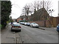
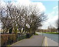
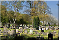
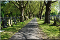

100 photos from this area
Area Information
Key information about the M20 2EU including its size, population, and administrative classification.
- Area Type
- Postcode
- Area Size
- 8387 m²
- Population
- 1446
- Population Density
- 5725 people/km²
House Prices in M20 2EU
81
Properties
£205,202
Average Sold Price
£37,500
Lowest Price
£487,500
Highest Price
Showing 81 properties
| Address | Type | Beds | Baths | Last Sale Price | Last Sale Date | |
|---|---|---|---|---|---|---|
| 69 The Boulevard, Manchester, M20 2EU | Flat | 2 | 2 | £213,155 | May 2025 | |
| 60 The Boulevard, Manchester, M20 2EU | Flat | - | - | £180,000 | Mar 2025 | |
| 46 The Boulevard, Manchester, M20 2EU | Flat | 1 | 1 | £170,000 | Jan 2025 | |
| 84 The Boulevard, Manchester, M20 2EU | Flat | - | - | £208,000 | Aug 2024 | |
| 12 The Boulevard, Manchester, M20 2EU | Terraced | 4 | 3 | £487,500 | Jul 2024 | |
| 1A The Boulevard, Manchester, M20 2EU | Flat | 1 | 1 | £197,500 | Nov 2023 | |
| 43 The Boulevard, Manchester, M20 2EU | Flat | - | - | £235,000 | Sep 2023 | |
| 54 The Boulevard, Manchester, M20 2EU | Flat | - | - | £180,000 | Sep 2023 | |
| 45 The Boulevard, Manchester, M20 2EU | Flat | - | - | £242,000 | Mar 2023 | |
| 42 The Boulevard, Manchester, M20 2EU | Flat | 1 | 1 | £173,900 | Dec 2022 |
Page 1 of 9
Energy Efficiency in M20 2EU
Amenities
Schools
| Rank | School | Type | Entry gender | Ages |
|---|
Explore more schools in this area
Go to Schools tabDemographics
Household Size
Two person
most common
Accommodation Type
Flats
most common
Tenure
49
majority
Ethnic Group
White
most common
Religion
N/A
most common
Household Composition
N/A
most common
Age
47
median
Adults (30-64 years)
most common
Household Deprivation
N/A
with no deprivation
NS-SEC
74
in Lower managerial occupations
Explore more demographic insights in this area
Go to Demographics tabPlanning
Planning Constraints
- Flood RiskPremium
- Ramsar Wetland SitesPremium
- Area of Outstanding Natural BeautyPremium
- Protected Nature ReservePremium
- Protected WoodlandPremium