Area Overview for M20 2EB
Photos of M20 2EB

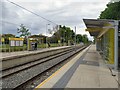
100 photos from this area
Area Information
Key information about the M20 2EB including its size, population, and administrative classification.
- Area Type
- Postcode
- Area Size
- 1.7 hectares
- Population
- 1446
- Population Density
- 5725 people/km²
House Prices in M20 2EB
75
Properties
£243,852
Average Sold Price
£133,000
Lowest Price
£470,000
Highest Price
Showing 75 properties
| Address | Type | Beds | Baths | Last Sale Price | Last Sale Date | |
|---|---|---|---|---|---|---|
| 25 Montmano Drive, Manchester, M20 2EB | Flat | 2 | 2 | £225,000 | Sep 2025 | |
| 108 Montmano Drive, Manchester, M20 2EB | Flat | 2 | 2 | £247,500 | May 2025 | |
| 84 Montmano Drive, Manchester, M20 2EB | Flat | 2 | 2 | £242,000 | Mar 2024 | |
| 60 Montmano Drive, Manchester, M20 2EB | Flat | - | - | £250,000 | Feb 2024 | |
| 26 Montmano Drive, Manchester, M20 2EB | Maisonette | 2 | 1 | £325,000 | Apr 2023 | |
| 15 Montmano Drive, Manchester, M20 2EB | Flat | 2 | 2 | £174,000 | Oct 2022 | |
| 102 Montmano Drive, Manchester, M20 2EB | Flat | 2 | 2 | £230,000 | Jun 2022 | |
| 19 Montmano Drive, Manchester, M20 2EB | Flat | - | - | £198,000 | Mar 2022 | |
| 32 Montmano Drive, Manchester, M20 2EB | Semi-detached | 3 | - | £410,000 | Jun 2021 | |
| 10 Montmano Drive, Manchester, M20 2EB | house | - | - | £415,000 | Jun 2021 |
Page 1 of 8
Energy Efficiency in M20 2EB
Amenities
Schools
| Rank | School | Type | Entry gender | Ages |
|---|
Explore more schools in this area
Go to Schools tabDemographics
Household Size
Two person
most common
Accommodation Type
Flats
most common
Tenure
49
majority
Ethnic Group
White
most common
Religion
N/A
most common
Household Composition
N/A
most common
Age
47
median
Adults (30-64 years)
most common
Household Deprivation
N/A
with no deprivation
NS-SEC
74
in Lower managerial occupations
Explore more demographic insights in this area
Go to Demographics tabPlanning
Planning Constraints
- Flood RiskPremium
- Ramsar Wetland SitesPremium
- Area of Outstanding Natural BeautyPremium
- Protected Nature ReservePremium
- Protected WoodlandPremium