Area Overview for M19 2AS
Photos of M19 2AS


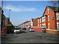
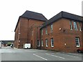
46 photos from this area
Area Information
Key information about the M19 2AS including its size, population, and administrative classification.
- Area Type
- Postcode
- Area Size
- 1.2 hectares
- Population
- 3735
- Population Density
- 7159 people/km²
House Prices in M19 2AS
29
Properties
£155,721
Average Sold Price
£26,012
Lowest Price
£325,000
Highest Price
Showing 29 properties
| Address | Type | Beds | Baths | Last Sale Price | Last Sale Date | |
|---|---|---|---|---|---|---|
| 16 Lytham Road, Manchester, M19 2AS | Retail | 3 | 1 | £325,000 | Mar 2022 | |
| 36 Lytham Road, Manchester, M19 2AS | Semi-detached | 3 | 1 | £256,000 | Nov 2018 | |
| 34 Lytham Road, Manchester, M19 2AS | Semi-detached | 3 | - | £227,500 | Sep 2016 | |
| 60 Lytham Road, Manchester, M19 2AS | Semi-detached | 3 | 1 | £172,000 | Mar 2016 | |
| 30 Lytham Road, Manchester, M19 2AS | Semi-detached | 3 | 1 | £205,000 | Sep 2015 | |
| 12 Lytham Road, Manchester, M19 2AS | Semi-detached | 3 | 1 | £167,500 | Jul 2015 | |
| 44 Lytham Road, Manchester, M19 2AS | Semi-detached | 3 | 2 | £170,000 | Oct 2014 | |
| 40 Lytham Road, Manchester, M19 2AS | house | - | - | £177,000 | Jul 2014 | |
| 26 Lytham Road, Manchester, M19 2AS | Semi-detached | 4 | 2 | £177,000 | Dec 2011 | |
| 32 Lytham Road, Manchester, M19 2AS | house | - | - | £107,000 | Sep 2009 |
Page 1 of 3
Energy Efficiency in M19 2AS
Amenities
Schools
| Rank | School | Type | Entry gender | Ages |
|---|
Explore more schools in this area
Go to Schools tabDemographics
Household Size
Family (3-5 people)
most common
Accommodation Type
Houses
most common
Tenure
42
majority
Ethnic Group
White
most common
Religion
N/A
most common
Household Composition
N/A
most common
Age
22
median
Young Adults (15-29 years)
most common
Household Deprivation
N/A
with no deprivation
NS-SEC
12
in Lower managerial occupations
Explore more demographic insights in this area
Go to Demographics tabPlanning
Planning Constraints
- Flood RiskPremium
- Ramsar Wetland SitesPremium
- Area of Outstanding Natural BeautyPremium
- Protected Nature ReservePremium
- Protected WoodlandPremium