Area Overview for M19 1LE
Photos of M19 1LE
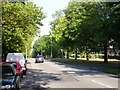
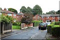
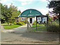
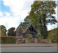
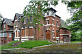
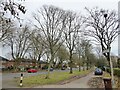
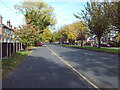
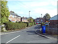
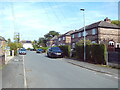
34 photos from this area
Area Information
Key information about the M19 1LE including its size, population, and administrative classification.
- Area Type
- Postcode
- Area Size
- 2.6 hectares
- Population
- 1738
- Population Density
- 6012 people/km²
House Prices in M19 1LE
39
Properties
£176,352
Average Sold Price
£43,000
Lowest Price
£325,000
Highest Price
Showing 39 properties
| Address | Type | Beds | Baths | Last Sale Price | Last Sale Date | |
|---|---|---|---|---|---|---|
| 75 Green End Road, Manchester, M19 1LE | Terraced | 3 | 1 | £263,000 | Jul 2024 | |
| 37 Green End Road, Manchester, M19 1LE | Semi-detached | 3 | 1 | £260,000 | Jun 2024 | |
| 85 Green End Road, Manchester, M19 1LE | Semi-detached | 3 | 1 | £325,000 | Apr 2024 | |
| 93 Green End Road, Manchester, M19 1LE | Semi-detached | 3 | 1 | £290,000 | Feb 2023 | |
| 73 Green End Road, Manchester, M19 1LE | Semi-detached | 5 | 2 | £263,000 | Oct 2018 | |
| 25 Green End Road, Manchester, M19 1LE | Terraced | 3 | - | £180,000 | May 2018 | |
| 45 Green End Road, Manchester, M19 1LE | Semi-detached | 3 | 1 | £129,000 | Jun 2014 | |
| 19 Green End Road, Manchester, M19 1LE | Semi-detached | 3 | 1 | £79,625 | Apr 2013 | |
| 67 Green End Road, Manchester, M19 1LE | house | 3 | 1 | £120,000 | Mar 2013 | |
| 27 Green End Road, Manchester, M19 1LE | Semi-detached | 3 | 1 | £124,950 | Aug 2011 |
Page 1 of 4
Energy Efficiency in M19 1LE
Amenities
Schools
| Rank | School | Type | Entry gender | Ages |
|---|
Explore more schools in this area
Go to Schools tabDemographics
Household Size
Family (3-5 people)
most common
Accommodation Type
Houses
most common
Tenure
44
majority
Ethnic Group
White
most common
Religion
N/A
most common
Household Composition
N/A
most common
Age
47
median
Adults (30-64 years)
most common
Household Deprivation
N/A
with no deprivation
NS-SEC
21
in Lower managerial occupations
Explore more demographic insights in this area
Go to Demographics tabPlanning
Planning Constraints
- Flood RiskPremium
- Ramsar Wetland SitesPremium
- Area of Outstanding Natural BeautyPremium
- Protected Nature ReservePremium
- Protected WoodlandPremium