Area Overview for M19 1LL
Photos of M19 1LL
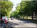
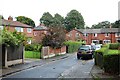

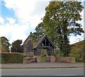
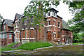
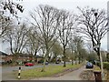
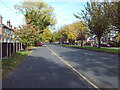
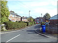
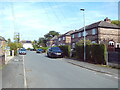

34 photos from this area
Area Information
Key information about the M19 1LL including its size, population, and administrative classification.
- Area Type
- Postcode
- Area Size
- 1.6 hectares
- Population
- 1738
- Population Density
- 6012 people/km²
House Prices in M19 1LL
34
Properties
£111,967
Average Sold Price
£14,800
Lowest Price
£272,000
Highest Price
Showing 34 properties
| Address | Type | Beds | Baths | Last Sale Price | Last Sale Date | |
|---|---|---|---|---|---|---|
| 20 Green End Road, Manchester, M19 1LL | house | - | - | £210,000 | Jul 2025 | |
| 74 Green End Road, Manchester, M19 1LL | Semi-detached | 3 | 1 | £272,000 | Dec 2024 | |
| 28 Green End Road, Manchester, M19 1LL | house | - | - | £220,000 | Jun 2021 | |
| 80 Green End Road, Manchester, M19 1LL | house | - | - | £130,500 | Mar 2014 | |
| 56 Green End Road, Manchester, M19 1LL | house | - | - | £151,000 | Nov 2010 | |
| 50 Green End Road, Manchester, M19 1LL | house | - | - | £130,000 | Oct 2004 | |
| 40 Green End Road, Manchester, M19 1LL | Semi-detached | - | - | £72,000 | Jun 2003 | |
| 84 Green End Road, Manchester, M19 1LL | house | - | - | £77,500 | Aug 2002 | |
| 24 Green End Road, Manchester, M19 1LL | Terraced | - | - | £24,120 | Jan 2002 | |
| 66 Green End Road, Manchester, M19 1LL | Semi-detached | - | - | £14,800 | Nov 2001 |
Page 1 of 4
Energy Efficiency in M19 1LL
Amenities
Schools
| Rank | School | Type | Entry gender | Ages |
|---|
Explore more schools in this area
Go to Schools tabDemographics
Household Size
Family (3-5 people)
most common
Accommodation Type
Houses
most common
Tenure
44
majority
Ethnic Group
White
most common
Religion
N/A
most common
Household Composition
N/A
most common
Age
47
median
Adults (30-64 years)
most common
Household Deprivation
N/A
with no deprivation
NS-SEC
21
in Lower managerial occupations
Explore more demographic insights in this area
Go to Demographics tabPlanning
Planning Constraints
- Flood RiskPremium
- Ramsar Wetland SitesPremium
- Area of Outstanding Natural BeautyPremium
- Protected Nature ReservePremium
- Protected WoodlandPremium