Area Overview for M19 1FE
Photos of M19 1FE
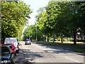
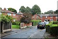

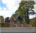
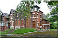
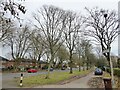
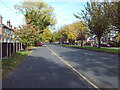
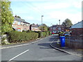
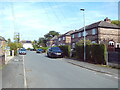


34 photos from this area
Area Information
Key information about the M19 1FE including its size, population, and administrative classification.
- Area Type
- Postcode
- Area Size
- 4410 m²
- Population
- 1901
- Population Density
- 8506 people/km²
House Prices in M19 1FE
18
Properties
£264,250
Average Sold Price
£95,000
Lowest Price
£415,000
Highest Price
Showing 18 properties
| Address | Type | Beds | Baths | Last Sale Price | Last Sale Date | |
|---|---|---|---|---|---|---|
| 179 Burnage Lane, Manchester, M19 1FE | Semi-detached | 4 | 3 | £415,000 | Mar 2025 | |
| 175 Burnage Lane, Manchester, M19 1FE | Semi-detached | 3 | 1 | £351,250 | May 2021 | |
| 177 Burnage Lane, Manchester, M19 1FE | house | 1 | 1 | £400,000 | Jan 2021 | |
| 181 Burnage Lane, Manchester, M19 1FE | Flat | 2 | 1 | £277,500 | Nov 2018 | |
| 203A Burnage Lane, Manchester, M19 1FE | Retail | 9 | - | £105,000 | May 2011 | |
| 191A Burnage Lane, Manchester, M19 1FE | Flat | - | - | £206,000 | Jul 2005 | |
| 193A Burnage Lane, Manchester, M19 1FE | Flat | 4 | 2 | £95,000 | Jun 2004 | |
| Flat 1, 185 Burnage Lane, Manchester, M19 1FE | Flat | 1 | 1 | - | - | |
| 189A Burnage Lane, Manchester, M19 1FE | Flat | - | - | - | - | |
| 195C Burnage Lane, Manchester, M19 1FE | Flat | - | - | - | - |
Page 1 of 2
Energy Efficiency in M19 1FE
Amenities
Schools
| Rank | School | Type | Entry gender | Ages |
|---|
Explore more schools in this area
Go to Schools tabDemographics
Household Size
Family (3-5 people)
most common
Accommodation Type
Houses
most common
Tenure
58
majority
Ethnic Group
White
most common
Religion
N/A
most common
Household Composition
N/A
most common
Age
47
median
Adults (30-64 years)
most common
Household Deprivation
N/A
with no deprivation
NS-SEC
26
in Lower managerial occupations
Explore more demographic insights in this area
Go to Demographics tabPlanning
Planning Constraints
- Flood RiskPremium
- Ramsar Wetland SitesPremium
- Area of Outstanding Natural BeautyPremium
- Protected Nature ReservePremium
- Protected WoodlandPremium