Area Overview for M16 0FE
Photos of M16 0FE
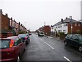
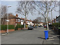
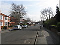
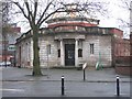


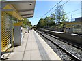

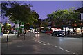
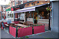
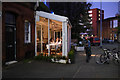
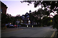
70 photos from this area
Area Information
Key information about the M16 0FE including its size, population, and administrative classification.
- Area Type
- Postcode
- Area Size
- 4847 m²
- Population
- 1567
- Population Density
- 6980 people/km²
House Prices in M16 0FE
9
Properties
£220,279
Average Sold Price
£48,950
Lowest Price
£550,000
Highest Price
Showing 9 properties
| Address | Type | Beds | Baths | Last Sale Price | Last Sale Date | |
|---|---|---|---|---|---|---|
| 165 Manchester Road, Chorlton, Manchester, M16 0FE | house | - | - | £550,000 | Jun 2022 | |
| 157 Manchester Road, Chorlton, Manchester, M16 0FE | Semi-detached | 3 | 2 | £248,000 | Oct 2014 | |
| 161 Manchester Road, Chorlton, Manchester, M16 0FE | house | 3 | - | £265,000 | May 2010 | |
| 155 Manchester Road, Chorlton, Manchester, M16 0FE | Semi-detached | 3 | 1 | £218,000 | Mar 2006 | |
| 159 Manchester Road, Chorlton, Manchester, M16 0FE | house | - | - | £158,000 | Dec 2002 | |
| 153 Manchester Road, Chorlton, Manchester, M16 0FE | house | - | - | £48,950 | Dec 1996 | |
| 149 Manchester Road, Chorlton, Manchester, M16 0FE | house | 3 | - | £54,000 | Aug 1995 | |
| 163 Manchester Road, Chorlton, Manchester, M16 0FE | Semi-detached | - | - | - | - | |
| 151 Manchester Road, Chorlton, Manchester, M16 0FE | Semi-detached | - | - | - | - |
Energy Efficiency in M16 0FE
Amenities
Schools
| Rank | School | Type | Entry gender | Ages |
|---|
Explore more schools in this area
Go to Schools tabDemographics
Household Size
Two person
most common
Accommodation Type
Houses
most common
Tenure
67
majority
Ethnic Group
White
most common
Religion
N/A
most common
Household Composition
N/A
most common
Age
47
median
Adults (30-64 years)
most common
Household Deprivation
N/A
with no deprivation
NS-SEC
45
in Lower managerial occupations
Explore more demographic insights in this area
Go to Demographics tabPlanning
Planning Constraints
- Flood RiskPremium
- Ramsar Wetland SitesPremium
- Area of Outstanding Natural BeautyPremium
- Protected Nature ReservePremium
- Protected WoodlandPremium