Area Overview for M16 0DZ
Photos of M16 0DZ
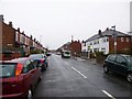
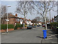
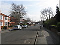


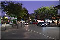


70 photos from this area
Area Information
Key information about the M16 0DZ including its size, population, and administrative classification.
- Area Type
- Postcode
- Area Size
- 9258 m²
- Population
- 1567
- Population Density
- 6980 people/km²
House Prices in M16 0DZ
50
Properties
£252,992
Average Sold Price
£59,950
Lowest Price
£700,000
Highest Price
Showing 50 properties
| Address | Type | Beds | Baths | Last Sale Price | Last Sale Date | |
|---|---|---|---|---|---|---|
| 148 Manchester Road, Chorlton, Manchester, M16 0DZ | house | 6 | 3 | £700,000 | Dec 2024 | |
| 154 Manchester Road, Chorlton, Manchester, M16 0DZ | house | - | - | £90,000 | May 2022 | |
| 140 Manchester Road, Chorlton, Manchester, M16 0DZ | house | 3 | - | £475,000 | Sep 2021 | |
| 150 Manchester Road, Chorlton, Manchester, M16 0DZ | Detached | 4 | - | £120,000 | Nov 2000 | |
| 144 Manchester Road, Chorlton, Manchester, M16 0DZ | house | 1 | 1 | £59,950 | Oct 1996 | |
| 138 Manchester Road, Chorlton, Manchester, M16 0DZ | house | - | - | £73,000 | Oct 1996 | |
| Flat 5, Conifers House, 158 Manchester Road, Chorlton, Manchester, M16 0DZ | Flat | 2 | 1 | - | - | |
| Flat 3, Conifers House, 158 Manchester Road, Chorlton, Manchester, M16 0DZ | Flat | 2 | 2 | - | - | |
| Flat 4, Conifers House, 158 Manchester Road, Chorlton, Manchester, M16 0DZ | Flat | 2 | 1 | - | - | |
| 156 Manchester Road, Chorlton, Manchester, M16 0DZ | house | 5 | 1 | - | - |
Page 1 of 5
Energy Efficiency in M16 0DZ
Amenities
Schools
| Rank | School | Type | Entry gender | Ages |
|---|
Explore more schools in this area
Go to Schools tabDemographics
Household Size
Two person
most common
Accommodation Type
Houses
most common
Tenure
67
majority
Ethnic Group
White
most common
Religion
N/A
most common
Household Composition
N/A
most common
Age
47
median
Adults (30-64 years)
most common
Household Deprivation
N/A
with no deprivation
NS-SEC
45
in Lower managerial occupations
Explore more demographic insights in this area
Go to Demographics tabPlanning
Planning Constraints
- Flood RiskPremium
- Ramsar Wetland SitesPremium
- Area of Outstanding Natural BeautyPremium
- Protected Nature ReservePremium
- Protected WoodlandPremium