Area Overview for M11 3UA
Photos of M11 3UA
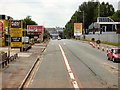
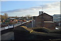
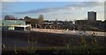

84 photos from this area
Area Information
Key information about the M11 3UA including its size, population, and administrative classification.
- Area Type
- Postcode
- Area Size
- 9120 m²
- Population
- 2955
- Population Density
- 5248 people/km²
House Prices in M11 3UA
40
Properties
£149,170
Average Sold Price
£79,950
Lowest Price
£249,995
Highest Price
Showing 40 properties
| Address | Type | Beds | Baths | Last Sale Price | Last Sale Date | |
|---|---|---|---|---|---|---|
| 18 Bell Crescent, Manchester, M11 3UA | Terraced | 1 | 2 | £120,000 | Jul 2025 | |
| 24 Bell Crescent, Manchester, M11 3UA | Terraced | 3 | 1 | £215,000 | Jul 2019 | |
| 8 Bell Crescent, Manchester, M11 3UA | Terraced | 1 | 1 | £97,500 | Aug 2017 | |
| 1 Bell Crescent, Manchester, M11 3UA | house | - | - | £165,000 | Mar 2017 | |
| 12 Bell Crescent, Manchester, M11 3UA | house | 3 | 1 | £180,000 | Jan 2017 | |
| 11 Bell Crescent, Manchester, M11 3UA | Semi-detached | - | - | £174,000 | Sep 2016 | |
| 15 Bell Crescent, Manchester, M11 3UA | house | - | - | £249,995 | Sep 2016 | |
| 13 Bell Crescent, Manchester, M11 3UA | house | - | - | £174,000 | Aug 2016 | |
| 26 Bell Crescent, Manchester, M11 3UA | Terraced | 3 | 3 | £160,000 | Feb 2016 | |
| 9 Bell Crescent, Manchester, M11 3UA | Semi-detached | 4 | 1 | £207,500 | Feb 2015 |
Page 1 of 4
Energy Efficiency in M11 3UA
Amenities
Schools
| Rank | School | Type | Entry gender | Ages |
|---|
Explore more schools in this area
Go to Schools tabDemographics
Household Size
Family (3-5 people)
most common
Accommodation Type
Houses
most common
Tenure
38
majority
Ethnic Group
White
most common
Religion
N/A
most common
Household Composition
N/A
most common
Age
47
median
Adults (30-64 years)
most common
Household Deprivation
N/A
with no deprivation
NS-SEC
30
in Lower managerial occupations
Explore more demographic insights in this area
Go to Demographics tabPlanning
Planning Constraints
- Flood RiskPremium
- Ramsar Wetland SitesPremium
- Area of Outstanding Natural BeautyPremium
- Protected Nature ReservePremium
- Protected WoodlandPremium