Area Overview for M11 3NP
Photos of M11 3NP
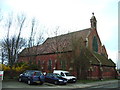
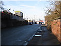
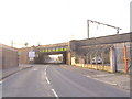
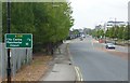
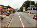
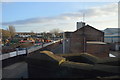
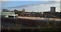
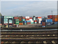
84 photos from this area
Area Information
Key information about the M11 3NP including its size, population, and administrative classification.
- Area Type
- Postcode
- Area Size
- 1.4 hectares
- Population
- 2955
- Population Density
- 5248 people/km²
House Prices in M11 3NP
78
Properties
£208,574
Average Sold Price
£146,000
Lowest Price
£340,000
Highest Price
Showing 78 properties
| Address | Type | Beds | Baths | Last Sale Price | Last Sale Date | |
|---|---|---|---|---|---|---|
| 32 Rylance Street, Manchester, M11 3NP | Terraced | 4 | 4 | £340,000 | Sep 2024 | |
| 3 Rylance Street, Manchester, M11 3NP | Terraced | 3 | 2 | £310,000 | Jun 2024 | |
| 4 Rylance Street, Manchester, M11 3NP | Terraced | 3 | 2 | £310,000 | Oct 2023 | |
| 39 Rylance Street, Manchester, M11 3NP | Terraced | 3 | 3 | £270,000 | Jun 2022 | |
| 11 Rylance Street, Manchester, M11 3NP | Terraced | 4 | 2 | £261,000 | Jun 2022 | |
| 10 Rylance Street, Manchester, M11 3NP | Semi-detached | 3 | 2 | £258,000 | Apr 2022 | |
| 35 Rylance Street, Manchester, M11 3NP | house | - | - | £230,000 | Mar 2021 | |
| 50 Rylance Street, Manchester, M11 3NP | Semi-detached | 3 | 1 | £235,000 | Dec 2020 | |
| 21 Rylance Street, Manchester, M11 3NP | house | - | - | £275,995 | Nov 2018 | |
| 19 Rylance Street, Manchester, M11 3NP | house | - | - | £224,995 | Nov 2018 |
Page 1 of 8
Energy Efficiency in M11 3NP
Amenities
Schools
| Rank | School | Type | Entry gender | Ages |
|---|
Explore more schools in this area
Go to Schools tabDemographics
Household Size
Family (3-5 people)
most common
Accommodation Type
Houses
most common
Tenure
38
majority
Ethnic Group
White
most common
Religion
N/A
most common
Household Composition
N/A
most common
Age
47
median
Adults (30-64 years)
most common
Household Deprivation
N/A
with no deprivation
NS-SEC
30
in Lower managerial occupations
Explore more demographic insights in this area
Go to Demographics tabPlanning
Planning Constraints
- Flood RiskPremium
- Ramsar Wetland SitesPremium
- Area of Outstanding Natural BeautyPremium
- Protected Nature ReservePremium
- Protected WoodlandPremium