Area Overview for Wyre District (B)
Photos of Wyre District (B)


Area Information
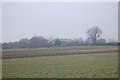
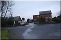
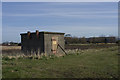
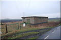
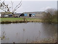
Wyre District sits on the coast north and east of Blackpool, covering a vast 328.6 square kilometres of North West England. The borough encompasses the towns of Cleveleys, Fleetwood, Garstang, Preesall and Thornton, alongside extensive rural areas and the Forest of Bowland Area of Outstanding Natural Beauty. You will find the council based in Poulton-le-Fylde, which serves as the local agricultural market centre. The landscape is defined by the River Wyre, which flows southwest past Garstang and Poulton-le-Fylde to the Irish Sea at Fleetwood. Daily life here balances agricultural heritage with coastal living. The eastern parts lie within the Forest of Bowland, while the western side features reclaimed marshland under intensive cultivation near the coast. Fleetwood operates as a major fishing port on England's west coast and handles containerised shipping for chemicals, plastics and leather goods. Communication between different parts of the borough can be challenging because no road or rail connections exist either side of the Wyre estuary. Residents requiring travel across this divide must use the Wyre Estuary Ferry between Fleetwood and Knott End or take neighbouring routes via the Fylde district. The character of the area remains generally rural and agricultural, forming a low coastal plain with extensive sand beaches. This geography appeals to those seeking a semi-rural lifestyle, though you must accept the logistical limitations of the isolated settlements around Fleetwood and Thornton.
- Area Type
- District/Borough
- Area Size
- 328.6 km²
- Population
- Not available
- Population Density
- Not available
Demographics
Living in Wyre District (B) means engaging with a settled population where age and ownership patterns are distinct. The median age across the borough is 70, indicating a community skewed significantly towards older residents. This demographic profile suggests that schools near the area may cater largely to younger children from specific family clusters rather than a broad age range of students. With a median age at 70, the typical household dynamic likely reflects multi-generational living or retired couples. Home ownership stands at 74%, confirming that the vast majority of properties in Wyre District (B) are occupied by their owners rather than tenants. This high level of equity implies a stable residential environment where residents often build long-term ties to their neighbourhoods. The area's total household composition and predominant ethnicity reflect a consistent, non-migratory population typical of historic English coastal towns. Religion and other sociological data point to a traditional community structure without rapid demographic shifts. You can expect a quiet, established community where the average resident is significantly older than the national norm. The 70-year median age suggests that services and local businesses are tailored to retirement living and leisure rather than young families seeking urban amenities.
Household Size
Accommodation Type
Tenure
Ethnic Group
Religion
Household Composition
Age
Household Deprivation
NS-SEC
Explore more demographic insights in this area
Go to Demographics tabPlanning
Planning Constraints
- Flood RiskPremium
- Ramsar Wetland SitesPremium
- Area of Outstanding Natural BeautyPremium
- Protected Nature ReservePremium
- Protected WoodlandPremium