Area Overview for Warton
Photos of Warton


Area Information
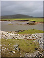
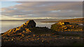
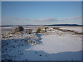
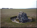
Living in Warton defines a distinctly rural lifestyle set within a civil parish covering 26.7 square kilometres. This location in England offers a quiet retreat where the pace of life is dictated by nature rather than urban traffic or commercial centres. You will find a community deeply rooted in stability, characterised by low density and significant green spaces. The area shines for those seeking isolation without leaving the country, providing a backdrop of open land that contrasts sharply with busier towns nearby. Daily life revolves around a deep connection to the local environment, with the landscape shaping your routine more than convenience stores or supermarkets. While you do not have the salts of urban proximity, you gain unparalleled space and peace. The parish structure suggests a strong sense of local identity and shared responsibility for the area. You will experience a setting where the air is clear and the horizon is defined by fields and hedgerows rather than high-rise developments. This environment suits those who value simplicity and prefer their days measured in walks across green fields rather than commuting distances.
- Area Type
- Parish
- Area Size
- 26.7 km²
- Population
- Not available
- Population Density
- Not available
Demographics
The community in Warton reflects a mature population where nearly 70 per cent of residents are seniors. With a median age of 70, you are entering a neighbourhood dominated by older homeowners and retirees. This demographic profile means you will encounter a population with settled routines and deep local knowledge. The household composition aligns perfectly with this age profile, indicating families with children are less common here compared to other parts of the region. Financial stability for residents is evident through the exceptionally high home ownership rate of 84 per cent. The vast majority of homes in Warton are owned outright or mortgaged, rather than rented. This statistic confirms the area is a mature, owner-occupied enclave rather than a transient rental market. You will find little evidence of short-term tenancies or student housing displacing permanent residents. The stability of the population is further underscored by the fact that specific data on ethnic diversity and religious affiliation is not broken down in this dataset, but the high ownership rate suggests long-term settlement. Living here means joining a community where neighbours likely have been in the same house for decades.
Household Size
Accommodation Type
Tenure
Ethnic Group
Religion
Household Composition
Age
Household Deprivation
NS-SEC
Explore more demographic insights in this area
Go to Demographics tabPlanning
Planning Constraints
- Flood RiskPremium
- Ramsar Wetland SitesPremium
- Area of Outstanding Natural BeautyPremium
- Protected Nature ReservePremium
- Protected WoodlandPremium