Area Overview for Ellel
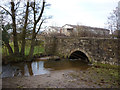
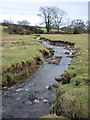
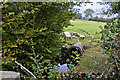
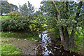
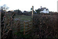
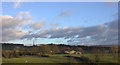
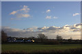
Photos of Ellel

Area Information
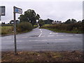
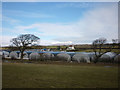
Ellel is a civil parish situated in the county of England, covering an area of 23.4 square kilometres. With a population of 2,085 residents, this relatively compact region supports a community density of 1,551 people per square kilometre. You will find a distinct neighbourhood character here, defined by its specific boundaries and local settlement patterns rather than a sprawling urban expansion. The size of the parish suggests a manageable distance between homes and local facilities, facilitating a slower pace of life compared to larger towns. Residents often describe daily existence as rooted in the immediate surroundings, where the parish limits create a clear sense of community identity. When considering living in Ellel, you are entering a specific environment with defined geographical constraints. The population figure indicates a stable community that is neither rapidly expanding nor decaying quickly. This specific demographic cluster shapes the local services and social scene available to homeowners and renters alike. The area's classification as a civil parish grants it a degree of local governance autonomy, influencing how neighbourhood issues are addressed. Prospective buyers looking for proximity to this exact hub will find a location with established boundaries and a contained population spread. The combination of these physical and social factors creates a unique setting for settlement within the wider region.
- Area Type
- Parish
- Area Size
- 23.4 km²
- Population
- 2085
- Population Density
- 1551 people/km²
Demographics
The community within Ellel reflects a settled population with clear demographic markers. The median age stands at 70 years, indicating that the majority of residents are seniors or elderly individuals. This age profile dominates the local scene, shaping everything from local demand to social activities. One third of the population falls into the oldest age bracket, reinforcing the inter-generational nature of the settlement. With 76% of the area owned, home ownership is significantly higher than the national average, suggesting long-term residents rather than transient tenants. This high proportion of owners typically signals a stable neighbourhood where people remain in their properties for decades. Household composition data confirms that the area caters primarily to those with significant life savings or inherited assets, given the age skew. The total household count aligns with the low population density limits of the parish. You will find that most families have moved here as adults or taken occupancy late in their lives. The ethnic composition and religious affiliation follow the total demographic trend, reflecting a community that mirrors broader regional patterns. For those researching schools near Ellel, the age data suggests a school could cater predominantly to primary ages if new students arrive from outside the parish. The demographic structure is straightforward: an older, owner-heavy community with limited turnover. This stability offers predictability for anyone seeking to understand the local social fabric.
Household Size
Accommodation Type
Tenure
Ethnic Group
Religion
Household Composition
Age
Household Deprivation
NS-SEC
Explore more demographic insights in this area
Go to Demographics tabPlanning
Planning Constraints
- Flood RiskPremium
- Ramsar Wetland SitesPremium
- Area of Outstanding Natural BeautyPremium
- Protected Nature ReservePremium
- Protected WoodlandPremium