Area Overview for Briercliffe
Photos of Briercliffe
Area Information
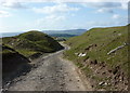
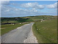
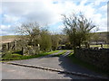
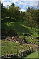
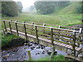
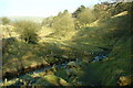
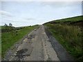
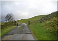
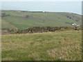
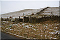
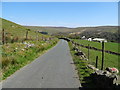
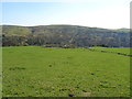
Briercliffe is a civil parish situated in the Burnley district of Lancashire, North West England. You will find this area lies within the historic boundaries of Whalley parish, encompassing specific localities like Haggate and Harle Syke. The parish formed in 1866, creating a distinct local identity separate from the larger regional history. The total area covers 16.9 km², providing a defined local boundary for community activities and daily life. Historically, the region first appeared in records in 1311 when Robert de Briercliffe held land in the township. This deep history is visible today in sites such as the seven-stone circle on Delf Hill, which dates from the Neolithic period. Residents might also visit the 16th-century Extwistle Hall on Extwistle Moor, now standing as a Tudor ruin. Living in Briercliffe means engaging with a location that blends centuries-old ancestry with a modern, settled pace. The site coordinates place it precisely at 53.810706, -2.200788. Notable landmarks include St James Church, built in 1841, and the former Haggate reading rooms which now function as a house on Halifax Road. For those seeking homes in Briercliffe, it is essential to appreciate the mix of industrial heritage, seen in the Harle Syke cotton mills, alongside significant prehistoric features like Burwains Camp. The population stands at approximately 1,368 people. This figure supports a range of local amenities, from the Baptist church on Burnley Road to the Neolithic stone circle. The community feels established, rooted in a timeline that extends well before the Norman Conquest links tied it to the honour of Clitheroe. Daily life here revolves around these fixed points of interest and the surrounding landscape.
- Area Type
- Parish
- Area Size
- 16.9 km²
- Population
- Not available
- Population Density
- Not available
Demographics
The community profile in Briercliffe reveals a distinct population structure focused on older residents. The median age is 70, which significantly exceeds the national average. This demographic skew indicates that the area is home primarily to retirees rather than families with young children or working-age adults. When examining household composition and accommodation types, specific data points are not provided in the current records. You must rely on the explicit age statistic to understand the social fabric of the parish. With 80 per cent of the population comprising owner-occupiers, property tenure is overwhelmingly established among residents who have likely lived in their homes for many years. This high home ownership rate often correlates with the older median age, as younger buyers may find the market less accessible or less attractive. Diversity statistics and ethnicity data are not included in the current information set. You should therefore focus your understanding on the age and ownership figures that are confirmed. The population of 1,368 people means that community services operate on a small scale. Living in Briercliffe means interacting with a neighbourhood where almost four out of five residents own their homes. The age profile suggests a quiet environment, potentially less noisy than areas dominated by young families. However, the lack of specified data on household composition limits a full picture of family units. The 80 per cent ownership figure remains the most reliable indicator of the area's character. It signals stability and a lack of transient renting within the parish boundaries.
Household Size
Accommodation Type
Tenure
Ethnic Group
Religion
Household Composition
Age
Household Deprivation
NS-SEC
Explore more demographic insights in this area
Go to Demographics tabPlanning
Planning Constraints
- Flood RiskPremium
- Ramsar Wetland SitesPremium
- Area of Outstanding Natural BeautyPremium
- Protected Nature ReservePremium
- Protected WoodlandPremium