Area Overview for LA9 6NA
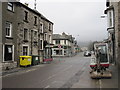
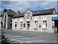
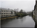
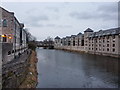
Photos of LA9 6NA


Area Information
LA9 6NA is a small, compact postcode area in England, covering just 1044 square metres and home to 2111 residents. Its high population density of 875 people per square kilometre suggests a tightly knit community, likely centred around local amenities and transport links. The area’s proximity to Kendal, a historic market town, offers easy access to cultural and commercial hubs, while nearby railway stations such as Kendal and Oxenholme Lake District provide connections to larger cities. Daily life here is shaped by its residential character, with a focus on local shops, schools, and rail networks. The broadband score of 100 ensures seamless digital connectivity, though mobile coverage, at 81, is good but not exceptional. Residents face notable challenges, including a high flood risk and elevated crime rates, which may influence decisions about long-term residency. For those prioritising convenience and proximity to services, LA9 6NA offers a compact, functional living environment, though its limitations in safety and environmental resilience require careful consideration.
- Area Type
- Postcode
- Area Size
- 1044 m²
- Population
- 2111
- Population Density
- 875 people/km²
LA9 6NA is primarily an owner-occupied area, with 76% of residents living in homes they own. The accommodation type is predominantly houses, indicating a lack of high-density housing such as flats or apartments. This suggests a small, low-rise residential cluster with limited scope for expansion. The high home ownership rate and focus on single-family dwellings may make the area less attractive to renters or first-time buyers seeking more affordable or flexible housing options. The compact size of the postcode means the housing stock is likely limited, potentially increasing competition among buyers. For those considering purchase, the area’s stability and mature demographic profile could be appealing, though the small size may restrict choices. Proximity to Kendal and rail links adds value, but prospective buyers should weigh this against the area’s safety and environmental risks.
House Prices in LA9 6NA
No properties found in this postcode.
Energy Efficiency in LA9 6NA
Daily life in LA9 6NA is shaped by its proximity to retail and transport hubs. The area’s five notable retail venues include Sainsburys Kendal, Lidl Kendal, and Aldi New, providing access to grocery and convenience shopping. These stores cater to everyday needs, reducing the necessity for long commutes to larger centres. The rail network, with stations like Kendal and Burneside, offers easy access to nearby towns and attractions. While the data does not mention parks or leisure facilities, the presence of multiple retail options and rail links suggests a practical, service-oriented lifestyle. The compact nature of the area means amenities are within walking or short driving distance, enhancing convenience. However, the absence of detailed information on recreational spaces or dining options leaves gaps in understanding the full range of lifestyle opportunities.
Amenities
Schools
Residents of LA9 6NA have access to a mix of educational institutions, including The Queen Katherine School, which operates as both a primary school and an academy with a ‘good’ Ofsted rating. This provides a reliable option for primary education. Other nearby schools include Kendal Centre and the Hospital and Home Tuition Service (Cumbria), though their specific educational focus is not detailed. The presence of a rated academy suggests a commitment to quality education, though the absence of secondary schools in the immediate area may require families to travel to Kendal or further afield. The diversity of school types, from primary to specialist services, indicates a range of options for different educational needs. For families prioritising academic standards, The Queen Katherine School’s performance is a notable advantage, though the overall school landscape remains modest in scale.
| Rank | School | Type | Entry gender | Ages |
|---|
Explore more schools in this area
Go to Schools tabDemographics
The population of LA9 6NA is predominantly middle-aged, with a median age of 47 and the largest age group being adults aged 30–64. This suggests a community of established professionals and families, with 76% of residents owning their homes. The area is characterised by a high proportion of owner-occupied houses, reflecting a stable, long-term demographic. The predominant ethnic group is White, with no specific data on other ethnicities provided. The age profile indicates a mature population, which may influence local services and amenities. However, the lack of younger residents could impact the demand for schools and childcare facilities. The high home ownership rate implies a lower turnover of properties, potentially creating a quieter, more settled neighbourhood. For buyers, this demographic profile suggests a focus on practicality and long-term investment rather than transient rental markets.
Household Size
Accommodation Type
Tenure
Ethnic Group
Religion
Household Composition
Age
Household Deprivation
NS-SEC
Explore more demographic insights in this area
Go to Demographics tabPlanning
Planning Constraints
- Flood RiskPremium
- Ramsar Wetland SitesPremium
- Area of Outstanding Natural BeautyPremium
- Protected Nature ReservePremium
- Protected WoodlandPremium