Area Overview for LA9 6NL
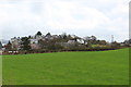
Photos of LA9 6NL


Area Information
Living in LA9 6NL means being part of a compact, residential cluster in England’s Lake District, where the landscape and community life intersect. The area covers just 9 hectares, yet it supports a population of 2,111 people, translating to a high density of 875 people per square kilometre. This small postcode area is likely nestled near Kendal, a town known for its historic charm and proximity to natural attractions. Daily life here is shaped by its proximity to rail networks, including Kendal and Oxenholme Lake District stations, which connect residents to broader regional hubs. The area’s mix of local amenities, such as Sainsburys and Morrisons, ensures practical convenience. Schools like The Queen Katherine School, rated good by Ofsted, cater to families, while the predominantly owner-occupied housing stock suggests a stable, long-term community. However, the area’s small size means that residents may need to venture slightly beyond LA9 6NL for more extensive services or leisure options.
- Area Type
- Postcode
- Area Size
- 9.0 hectares
- Population
- 2111
- Population Density
- 875 people/km²
The property market in LA9 6NL is dominated by owner-occupied homes, with 76% of residents owning their properties. The accommodation type is primarily houses, which is typical for smaller, residential postcode areas. This suggests a market focused on private buyers rather than renters, though the limited area size means the housing stock is likely constrained. The high home ownership rate may reflect long-term residency and a desire for stability, but buyers should consider the proximity to larger towns like Kendal for more extensive property options. The predominance of houses could appeal to families seeking space, though the area’s compact nature may require looking beyond LA9 6NL for larger developments or alternative housing types.
House Prices in LA9 6NL
No properties found in this postcode.
Energy Efficiency in LA9 6NL
The lifestyle in LA9 6NL is shaped by its proximity to essential amenities and natural surroundings. Residents have access to five retail outlets, including Sainsburys Kendal, Morrisons New, and Aldi New, ensuring everyday shopping needs are met. The rail network, with stations like Kendal and Oxenholme Lake District, provides easy access to the Lake District and beyond, supporting both local and regional travel. While the area’s small size limits large-scale leisure options, its position near Kendal offers cultural and recreational opportunities. The blend of retail convenience and transport links creates a practical, community-focused lifestyle, ideal for those prioritising accessibility over expansive urban amenities.
Amenities
Schools
Residents of LA9 6NL have access to a range of educational institutions, including The Queen Katherine School, which operates as both a primary school and an academy with a good Ofsted rating. This dual designation suggests a well-established educational provision for younger children. Nearby, Kendal Centre and the Hospital and Home Tuition Service (Cumbria) offer additional learning and support options. The presence of a rated good school indicates a commitment to quality education, which is crucial for families. However, the absence of secondary schools in the immediate area may necessitate travel to Kendal or other nearby towns for higher education. The mix of school types ensures a comprehensive approach to education, from early years to specialist support services.
| Rank | School | Type | Entry gender | Ages |
|---|
Explore more schools in this area
Go to Schools tabDemographics
The demographic profile of LA9 6NL reflects a mature, established population. The median age is 47, with the majority of residents falling within the 30-64 age range, indicating a community of working-age adults and families. Home ownership is high at 76%, suggesting a strong presence of long-term residents rather than renters. The accommodation type is predominantly houses, aligning with the area’s residential character. The predominant ethnic group is White, though specific data on diversity or deprivation is not provided. This demographic structure implies a stable, low-turnover community where families and professionals are likely to settle. The high proportion of owner-occupied homes may also indicate lower rental demand, shaping the local property market.
Household Size
Accommodation Type
Tenure
Ethnic Group
Religion
Household Composition
Age
Household Deprivation
NS-SEC
Explore more demographic insights in this area
Go to Demographics tabPlanning
Planning Constraints
- Flood RiskPremium
- Ramsar Wetland SitesPremium
- Area of Outstanding Natural BeautyPremium
- Protected Nature ReservePremium
- Protected WoodlandPremium