Area Overview for LA11 7DY
Photos of LA11 7DY
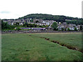

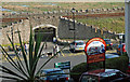
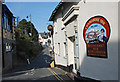
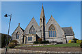
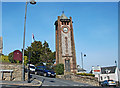
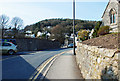
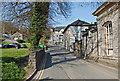
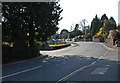

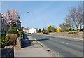
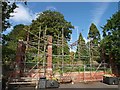
100 photos from this area
Area Information
Key information about the LA11 7DY including its size, population, and administrative classification.
- Area Type
- Postcode
- Area Size
- 9112 m²
- Population
- 1425
- Population Density
- 425 people/km²
House Prices in LA11 7DY
10
Properties
£307,000
Average Sold Price
£130,000
Lowest Price
£425,000
Highest Price
Showing 10 properties
| Address | Type | Beds | Baths | Last Sale Price | Last Sale Date | |
|---|---|---|---|---|---|---|
| Seefeld, 8 Heads Drive, Grange Over Sands, LA11 7DY | Bungalow | 3 | 2 | £400,000 | Jul 2025 | |
| Millfield, 9 Heads Drive, Grange Over Sands, LA11 7DY | house | - | - | £415,000 | Aug 2017 | |
| Amberley, 4 Heads Drive, Grange Over Sands, LA11 7DY | Bungalow | - | - | £295,000 | Aug 2015 | |
| 15 Heads Drive, Grange Over Sands, LA11 7DY | Bungalow | 3 | - | £325,000 | Sep 2013 | |
| Oakdene, 3 Heads Drive, Grange Over Sands, LA11 7DY | Detached | - | - | £425,000 | Jun 2008 | |
| Eildon, 7 Heads Drive, Grange Over Sands, LA11 7DY | Detached | - | - | £130,000 | Jan 1998 | |
| Hillside Lodge, 11 Heads Drive, Grange Over Sands, LA11 7DY | Detached | 4 | 3 | £159,000 | Sep 1997 | |
| Arncliffe Cottage, 5 Heads Drive, Grange Over Sands, LA11 7DY | Detached | - | - | - | - | |
| Stone Lea, 1 Heads Drive, Grange Over Sands, LA11 7DY | Detached | - | - | - | - | |
| Rose Tor, 2 Heads Drive, Grange Over Sands, LA11 7DY | Bungalow | - | - | - | - |
Energy Efficiency in LA11 7DY
Amenities
Schools
| Rank | School | Type | Entry gender | Ages |
|---|
Explore more schools in this area
Go to Schools tabDemographics
Household Size
Two person
most common
Accommodation Type
Houses
most common
Tenure
89
majority
Ethnic Group
White
most common
Religion
N/A
most common
Household Composition
N/A
most common
Age
70
median
Elderly (65+ years)
most common
Household Deprivation
N/A
with no deprivation
NS-SEC
48
in Lower managerial occupations
Explore more demographic insights in this area
Go to Demographics tabPlanning
Planning Constraints
- Flood RiskPremium
- Ramsar Wetland SitesPremium
- Area of Outstanding Natural BeautyPremium
- Protected Nature ReservePremium
- Protected WoodlandPremium