Area Overview for LA11 7EF
Photos of LA11 7EF
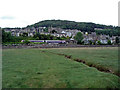
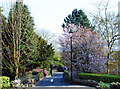
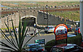
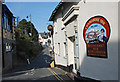
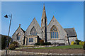
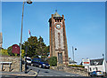
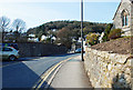
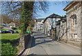

100 photos from this area
Area Information
Key information about the LA11 7EF including its size, population, and administrative classification.
- Area Type
- Postcode
- Area Size
- 1.8 hectares
- Population
- 1524
- Population Density
- 1477 people/km²
House Prices in LA11 7EF
18
Properties
£331,096
Average Sold Price
£100,000
Lowest Price
£720,000
Highest Price
Showing 18 properties
| Address | Type | Beds | Baths | Last Sale Price | Last Sale Date | |
|---|---|---|---|---|---|---|
| Greenlea, Kents Bank Road, Grange Over Sands, LA11 7EF | house | - | - | £720,000 | Mar 2021 | |
| White Garth House, Kents Bank Road, Grange Over Sands, LA11 7EF | Detached | 5 | 3 | £540,000 | May 2018 | |
| Fairhaven, Kents Bank Road, Grange Over Sands, LA11 7EF | house | - | - | £370,000 | Nov 2016 | |
| High Strand, Kents Bank Road, Grange Over Sands, LA11 7EF | Bungalow | - | - | £285,000 | Mar 2016 | |
| Silver How, Kents Bank Road, Grange Over Sands, LA11 7EF | Bungalow | 3 | - | £275,000 | Sep 2015 | |
| Sunnyfield, Kents Bank Road, Grange Over Sands, LA11 7EF | Semi-detached | 3 | - | £200,000 | Feb 2015 | |
| Maple Garth, Kents Bank Road, Grange Over Sands, LA11 7EF | house | - | - | £442,500 | Mar 2009 | |
| Ladymead, Kents Bank Road, Grange Over Sands, LA11 7EF | Detached | - | - | £382,500 | Nov 2006 | |
| Lancaster Gate, 1 Kents Bank Road, Grange Over Sands, LA11 7EF | Flat | - | - | £127,058 | Sep 2006 | |
| Brandwood House, Kents Bank Road, Grange Over Sands, LA11 7EF | house | - | - | £100,000 | Jul 2003 |
Page 1 of 2
Energy Efficiency in LA11 7EF
Amenities
Schools
| Rank | School | Type | Entry gender | Ages |
|---|
Explore more schools in this area
Go to Schools tabDemographics
Household Size
Two person
most common
Accommodation Type
Houses
most common
Tenure
77
majority
Ethnic Group
White
most common
Religion
N/A
most common
Household Composition
N/A
most common
Age
47
median
Adults (30-64 years)
most common
Household Deprivation
N/A
with no deprivation
NS-SEC
39
in Lower managerial occupations
Explore more demographic insights in this area
Go to Demographics tabPlanning
Planning Constraints
- Flood RiskPremium
- Ramsar Wetland SitesPremium
- Area of Outstanding Natural BeautyPremium
- Protected Nature ReservePremium
- Protected WoodlandPremium