Area Overview for L4 2RG
Photos of L4 2RG


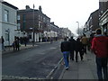
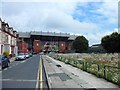
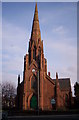
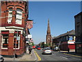

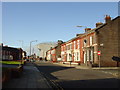
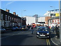
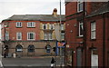
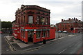

60 photos from this area
Area Information
Key information about the L4 2RG including its size, population, and administrative classification.
- Area Type
- Postcode
- Area Size
- 3032 m²
- Population
- 1338
- Population Density
- 12076 people/km²
House Prices in L4 2RG
21
Properties
£74,088
Average Sold Price
£16,400
Lowest Price
£140,000
Highest Price
Showing 21 properties
| Address | Type | Beds | Baths | Last Sale Price | Last Sale Date | |
|---|---|---|---|---|---|---|
| 27 Douglas Road, Liverpool, L4 2RG | Terraced | 4 | 1 | £140,000 | Feb 2024 | |
| 21 Douglas Road, Liverpool, L4 2RG | Terraced | 4 | 1 | £133,000 | Nov 2023 | |
| 29 Douglas Road, Liverpool, L4 2RG | Terraced | 5 | - | £120,000 | Jul 2022 | |
| 11 Douglas Road, Liverpool, L4 2RG | house | - | - | £107,000 | May 2021 | |
| 25 Douglas Road, Liverpool, L4 2RG | Terraced | 4 | - | £80,000 | Dec 2017 | |
| 31 Douglas Road, Liverpool, L4 2RG | Terraced | 4 | - | £44,500 | Jun 2017 | |
| 1 Douglas Road, Liverpool, L4 2RG | Terraced | 4 | - | £84,653 | Sep 2015 | |
| 23 Douglas Road, Liverpool, L4 2RG | Terraced | 4 | - | £50,000 | Mar 2015 | |
| 19 Douglas Road, Liverpool, L4 2RG | Terraced | 4 | 1 | £57,000 | Dec 2003 | |
| 13 Douglas Road, Liverpool, L4 2RG | Terraced | - | - | £40,000 | May 2002 |
Page 1 of 3
Energy Efficiency in L4 2RG
Amenities
Schools
| Rank | School | Type | Entry gender | Ages |
|---|
Explore more schools in this area
Go to Schools tabDemographics
Household Size
One person
most common
Accommodation Type
Houses
most common
Tenure
46
majority
Ethnic Group
White
most common
Religion
N/A
most common
Household Composition
N/A
most common
Age
47
median
Adults (30-64 years)
most common
Household Deprivation
N/A
with no deprivation
NS-SEC
17
in Lower managerial occupations
Explore more demographic insights in this area
Go to Demographics tabPlanning
Planning Constraints
- Flood RiskPremium
- Ramsar Wetland SitesPremium
- Area of Outstanding Natural BeautyPremium
- Protected Nature ReservePremium
- Protected WoodlandPremium