Area Overview for L37 3PS
Photos of L37 3PS
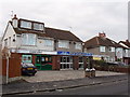
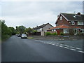

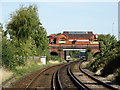
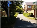


41 photos from this area
Area Information
Key information about the L37 3PS including its size, population, and administrative classification.
- Area Type
- Postcode
- Area Size
- 6513 m²
- Population
- 1584
- Population Density
- 3002 people/km²
House Prices in L37 3PS
86
Properties
£134,460
Average Sold Price
£62,500
Lowest Price
£230,450
Highest Price
Showing 86 properties
| Address | Type | Beds | Baths | Last Sale Price | Last Sale Date | |
|---|---|---|---|---|---|---|
| 15, Hillary Court, Freshfield Road, Formby, L37 3PS | Flat | - | - | £98,500 | Dec 2025 | |
| 22, Hillary Court, Freshfield Road, Formby, L37 3PS | Flat | 1 | 1 | £162,500 | Nov 2025 | |
| 25, Hillary Court, Freshfield Road, Formby, L37 3PS | Flat | 1 | 1 | £92,500 | Jul 2025 | |
| 75, Hillary Court, Freshfield Road, Formby, L37 3PS | Flat | - | - | £99,000 | May 2025 | |
| 12, Hillary Court, Freshfield Road, Formby, L37 3PS | Flat | - | - | £105,000 | May 2025 | |
| 80, Hillary Court, Freshfield Road, Formby, L37 3PS | Flat | 2 | 1 | £183,999 | Mar 2025 | |
| 21, Hillary Court, Freshfield Road, Formby, L37 3PS | Flat | - | - | £115,000 | Jan 2025 | |
| 4, Hillary Court, Freshfield Road, Formby, L37 3PS | Flat | - | - | £150,000 | Nov 2024 | |
| 1, Hillary Court, Freshfield Road, Formby, L37 3PS | Flat | - | - | £100,000 | Nov 2024 | |
| 54, Hillary Court, Freshfield Road, Formby, L37 3PS | Flat | - | - | £96,000 | Oct 2024 |
Page 1 of 9
Energy Efficiency in L37 3PS
Amenities
Schools
| Rank | School | Type | Entry gender | Ages |
|---|
Explore more schools in this area
Go to Schools tabDemographics
Household Size
One person
most common
Accommodation Type
Houses
most common
Tenure
82
majority
Ethnic Group
White
most common
Religion
N/A
most common
Household Composition
N/A
most common
Age
47
median
Adults (30-64 years)
most common
Household Deprivation
N/A
with no deprivation
NS-SEC
44
in Lower managerial occupations
Explore more demographic insights in this area
Go to Demographics tabPlanning
Planning Constraints
- Flood RiskPremium
- Ramsar Wetland SitesPremium
- Area of Outstanding Natural BeautyPremium
- Protected Nature ReservePremium
- Protected WoodlandPremium