Area Overview for L36 8DL
Photos of L36 8DL
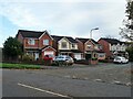
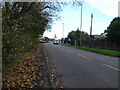
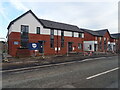
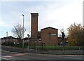

23 photos from this area
Area Information
Key information about the L36 8DL including its size, population, and administrative classification.
- Area Type
- Postcode
- Area Size
- 9335 m²
- Population
- 1385
- Population Density
- 5996 people/km²
House Prices in L36 8DL
17
Properties
£121,619
Average Sold Price
£70,000
Lowest Price
£155,000
Highest Price
Showing 17 properties
| Address | Type | Beds | Baths | Last Sale Price | Last Sale Date | |
|---|---|---|---|---|---|---|
| 81 Primrose Drive, Huyton, L36 8DL | Terraced | 3 | 1 | £145,000 | Jun 2024 | |
| 97 Primrose Drive, Huyton, L36 8DL | house | - | - | £155,000 | Jul 2022 | |
| 95 Primrose Drive, Huyton, L36 8DL | Semi-detached | 3 | 1 | £115,000 | Jul 2015 | |
| 105 Primrose Drive, Huyton, L36 8DL | Semi-detached | - | - | £70,000 | Mar 2014 | |
| 109 Primrose Drive, Huyton, L36 8DL | Bungalow | - | - | £125,000 | Jan 2014 | |
| 99 Primrose Drive, Huyton, L36 8DL | house | - | - | £122,000 | Apr 2013 | |
| 101 Primrose Drive, Huyton, L36 8DL | house | - | - | £130,000 | Feb 2013 | |
| 87 Primrose Drive, Huyton, L36 8DL | house | - | - | £110,950 | Apr 2004 | |
| 107 Primrose Drive, Huyton, L36 8DL | Semi-detached | - | - | - | - | |
| 79 Primrose Drive, Huyton, L36 8DL | house | - | - | - | - |
Page 1 of 2
Energy Efficiency in L36 8DL
Amenities
Schools
| Rank | School | Type | Entry gender | Ages |
|---|
Explore more schools in this area
Go to Schools tabDemographics
Household Size
Family (3-5 people)
most common
Accommodation Type
Houses
most common
Tenure
35
majority
Ethnic Group
White
most common
Religion
N/A
most common
Household Composition
N/A
most common
Age
47
median
Adults (30-64 years)
most common
Household Deprivation
N/A
with no deprivation
NS-SEC
13
in Lower managerial occupations
Explore more demographic insights in this area
Go to Demographics tabPlanning
Planning Constraints
- Flood RiskPremium
- Ramsar Wetland SitesPremium
- Area of Outstanding Natural BeautyPremium
- Protected Nature ReservePremium
- Protected WoodlandPremium