Area Overview for L36 5XZ
Photos of L36 5XZ
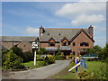
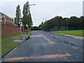


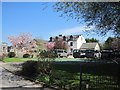
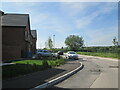
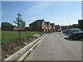
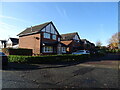


19 photos from this area
Area Information
Key information about the L36 5XZ including its size, population, and administrative classification.
- Area Type
- Postcode
- Area Size
- 7169 m²
- Population
- 1404
- Population Density
- 4970 people/km²
House Prices in L36 5XZ
25
Properties
£153,542
Average Sold Price
£81,500
Lowest Price
£350,000
Highest Price
Showing 25 properties
| Address | Type | Beds | Baths | Last Sale Price | Last Sale Date | |
|---|---|---|---|---|---|---|
| 95 Oak Road, Huyton, L36 5XZ | house | - | - | £350,000 | Jan 2025 | |
| 73 Oak Road, Huyton, L36 5XZ | Semi-detached | 3 | 1 | £220,000 | Mar 2023 | |
| 89 Oak Road, Huyton, L36 5XZ | Detached | 4 | 2 | £247,000 | Aug 2017 | |
| 57 Oak Road, Huyton, L36 5XZ | Semi-detached | - | - | £149,950 | Apr 2014 | |
| 71 Oak Road, Huyton, L36 5XZ | Terraced | 4 | - | £170,000 | Aug 2012 | |
| 49 Oak Road, Huyton, L36 5XZ | Terraced | - | - | £167,950 | Aug 2007 | |
| 75 Oak Road, Huyton, L36 5XZ | Semi-detached | - | - | £137,950 | Oct 2003 | |
| 61 Oak Road, Huyton, L36 5XZ | house | 3 | 1 | £81,500 | Jun 2001 | |
| 83 Oak Road, Huyton, L36 5XZ | Detached | - | - | £96,000 | May 2001 | |
| 85 Oak Road, Huyton, L36 5XZ | Detached | - | - | £93,000 | Oct 1998 |
Page 1 of 3
Energy Efficiency in L36 5XZ
Amenities
Schools
| Rank | School | Type | Entry gender | Ages |
|---|
Explore more schools in this area
Go to Schools tabDemographics
Household Size
Two person
most common
Accommodation Type
Houses
most common
Tenure
93
majority
Ethnic Group
White
most common
Religion
N/A
most common
Household Composition
N/A
most common
Age
47
median
Adults (30-64 years)
most common
Household Deprivation
N/A
with no deprivation
NS-SEC
41
in Lower managerial occupations
Explore more demographic insights in this area
Go to Demographics tabPlanning
Planning Constraints
- Flood RiskPremium
- Ramsar Wetland SitesPremium
- Area of Outstanding Natural BeautyPremium
- Protected Nature ReservePremium
- Protected WoodlandPremium