Area Overview for L36 1UP
Photos of L36 1UP


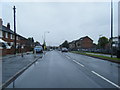
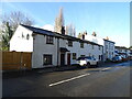

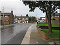
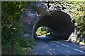


12 photos from this area
Area Information
Key information about the L36 1UP including its size, population, and administrative classification.
- Area Type
- Postcode
- Area Size
- 5137 m²
- Population
- 1463
- Population Density
- 7620 people/km²
House Prices in L36 1UP
21
Properties
£68,563
Average Sold Price
£22,000
Lowest Price
£145,000
Highest Price
Showing 21 properties
| Address | Type | Beds | Baths | Last Sale Price | Last Sale Date | |
|---|---|---|---|---|---|---|
| 7 Lancaster Road, Huyton, L36 1UP | Terraced | 3 | 1 | £145,000 | Jun 2024 | |
| 13 Lancaster Road, Huyton, L36 1UP | house | - | - | £65,000 | Mar 2021 | |
| 35 Lancaster Road, Huyton, L36 1UP | Terraced | - | - | £90,000 | Nov 2013 | |
| 17 Lancaster Road, Huyton, L36 1UP | house | - | - | £60,000 | Sep 2013 | |
| 29 Lancaster Road, Huyton, L36 1UP | house | 3 | - | £60,000 | Aug 2013 | |
| 21 Lancaster Road, Huyton, L36 1UP | house | - | - | £75,000 | Apr 2004 | |
| 3 Lancaster Road, Huyton, L36 1UP | Terraced | - | - | £31,500 | Jul 1998 | |
| 33 Lancaster Road, Huyton, L36 1UP | house | - | - | £22,000 | Dec 1996 | |
| 1 Lancaster Road, Huyton, L36 1UP | Terraced | 3 | 1 | - | - | |
| 15 Lancaster Road, Huyton, L36 1UP | Terraced | - | - | - | - |
Page 1 of 3
Energy Efficiency in L36 1UP
Amenities
Schools
| Rank | School | Type | Entry gender | Ages |
|---|
Explore more schools in this area
Go to Schools tabDemographics
Household Size
One person
most common
Accommodation Type
Houses
most common
Tenure
58
majority
Ethnic Group
White
most common
Religion
N/A
most common
Household Composition
N/A
most common
Age
47
median
Adults (30-64 years)
most common
Household Deprivation
N/A
with no deprivation
NS-SEC
20
in Lower managerial occupations
Explore more demographic insights in this area
Go to Demographics tabPlanning
Planning Constraints
- Flood RiskPremium
- Ramsar Wetland SitesPremium
- Area of Outstanding Natural BeautyPremium
- Protected Nature ReservePremium
- Protected WoodlandPremium