Area Overview for L30 1QD
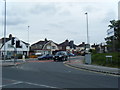
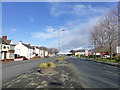
Photos of L30 1QD


Area Information
Living in L30 1QD means being part of a tightly knit residential cluster in England, where 1780 people reside across 298 square metres. The area’s high population density—nearly 6 million people per square kilometre—reflects its compact nature, typical of smaller postcode clusters. This is a community defined by stability, with 81% of homes owned by residents rather than rented. The area’s proximity to rail, ferry, and retail hubs ensures daily life is practical, with Aldi Netherton and Aintree Railway Station within easy reach. While the landscape lacks protected natural sites, the low flood risk and below-average crime rates contribute to a sense of security. For those prioritising convenience, L30 1QD offers a balance of accessibility and quiet living, with no major planning constraints. Its character lies in its simplicity: a place where homes are primarily houses, and the population skews towards adults aged 30–64. This is a small area with a focused identity, ideal for those seeking a manageable, low-risk environment.
- Area Type
- Postcode
- Area Size
- 298 m²
- Population
- 1780
- Population Density
- 3895 people/km²
The property market in L30 1QD is characterised by high home ownership—81% of properties are owner-occupied—suggesting a stable, long-term resident base. The accommodation type is predominantly houses, which is unusual for a small postcode area but aligns with the compact, residential nature of the cluster. This implies limited housing stock, with few flats or shared properties. For buyers, this means the market is unlikely to be competitive in terms of rental availability, as most properties are privately owned. The area’s small size means that property values may be influenced by proximity to nearby amenities such as Aintree Railway Station and Liverpool Belfast Ferry Terminal. Buyers should consider the limited scope for expansion, as the area’s footprint is minimal. The absence of planning constraints also means development is unlikely to alter the existing housing stock significantly.
House Prices in L30 1QD
Showing 1 properties
| Address | Type | Beds | Baths | Last Sale Price | Last Sale Date | |
|---|---|---|---|---|---|---|
| 109 Park Lane, Netherton, L30 1QD | undefined | - | - | - | - |
Energy Efficiency in L30 1QD
Residents of L30 1QD have access to a range of practical amenities within close proximity. Retail options include Aldi Netherton, Spar Dunningsbridge, and M&S Aintree, offering everyday essentials. The area’s rail network, with stations like Aintree and Orrell Park, provides easy access to commuting routes, while ferry terminals such as Liverpool Belfast Ferry Terminal Bootle connect to major destinations. Though the area is small, its infrastructure ensures convenience without the need for long journeys. The presence of multiple railway and ferry options suggests a community prioritising mobility, whether for work, leisure, or travel. While there are no named parks or leisure facilities in the data, the absence of planning constraints and low environmental risks implies open spaces may exist nearby. Overall, the lifestyle in L30 1QD balances accessibility with the simplicity of a compact, focused postcode cluster.
Amenities
Schools
| Rank | School | Type | Entry gender | Ages |
|---|
Explore more schools in this area
Go to Schools tabDemographics
The community in L30 1QD is predominantly composed of adults aged 30–64, with a median age of 47. This suggests a mature, established population, likely with long-term ties to the area. Home ownership is high at 81%, indicating a stable housing market with few rental properties. The accommodation type is primarily houses, which aligns with the area’s low population density and compact footprint. The predominant ethnic group is White, though no further breakdown of diversity is provided. The data does not specify deprivation levels, but the high home ownership and low crime risk imply a relatively affluent or secure environment. For buyers, this demographic profile suggests a community with strong local ties and a focus on long-term residency rather than transient populations. The absence of protected natural areas or planning constraints further supports a practical, unobstructed lifestyle for residents.
Household Size
Accommodation Type
Tenure
Ethnic Group
Religion
Household Composition
Age
Household Deprivation
NS-SEC
Explore more demographic insights in this area
Go to Demographics tabPlanning
Planning Constraints
- Flood RiskPremium
- Ramsar Wetland SitesPremium
- Area of Outstanding Natural BeautyPremium
- Protected Nature ReservePremium
- Protected WoodlandPremium