Area Overview for L30 1QG
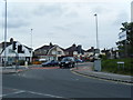
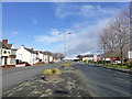
Photos of L30 1QG


Area Information
Living in L30 1QG means inhabiting a small, tightly knit residential cluster in England, where the population of 1,652 reflects a quiet, established community. This area is defined by its compact size and proximity to practical amenities, making it a convenient base for those prioritising accessibility over sprawling landscapes. The surrounding area includes retail hubs like Aldi Netherton and Spar Dunningsbridge, alongside rail connections such as Aintree Railway Station, which link residents to broader networks. Daily life here balances local simplicity with regional connectivity, offering a blend of small-town charm and commuter-friendly infrastructure. While the area lacks natural conservation designations, its low flood risk and absence of planning constraints mean development is unencumbered. For buyers, L30 1QG represents a niche market where property choices are limited but tailored to those seeking a stable, low-maintenance environment. The community’s age profile—peaking in adults aged 30–64—suggests a mature demographic, likely drawn by the area’s practicality and proximity to transport corridors.
- Area Type
- Postcode
- Area Size
- Not available
- Population
- 1652
- Population Density
- 2526 people/km²
The property market in L30 1QG is characterised by a low home ownership rate of 36%, meaning most residents rent rather than own their homes. This suggests a rental market that may be more competitive, with limited availability of owner-occupied properties. The accommodation type is predominantly houses, which is unusual for areas with higher population density, indicating a focus on single-family living. For buyers, this small area offers a niche opportunity: properties are likely to be family homes, potentially with larger gardens or more space than typical urban dwellings. However, the limited size of the area means the housing stock is not extensive, and buyers may need to consider nearby regions for more options. The low home ownership rate also implies that landlords may hold a significant portion of the market, which could influence pricing and availability for prospective buyers.
House Prices in L30 1QG
No properties found in this postcode.
Energy Efficiency in L30 1QG
The lifestyle in L30 1QG is shaped by its proximity to essential amenities, including five retail outlets such as Aldi Netherton, Spar Dunningsbridge, and M&S Aintree. These shops provide everyday convenience, from groceries to clothing, reducing the need for long trips. The area’s rail network, with stations like Aintree and Old Roan, connects residents to broader regional hubs, while ferry terminals like Liverpool Belfast and Seacombe offer access to intercity travel. Though the area lacks parks or leisure facilities, its practical amenities cater to daily needs without requiring extensive travel. The presence of multiple rail and ferry options also suggests a community that values mobility, whether for work, shopping, or leisure. For residents prioritising convenience over expansive green spaces, L30 1QG offers a compact, functional lifestyle with minimal reliance on cars.
Amenities
Schools
| Rank | School | Type | Entry gender | Ages |
|---|
Explore more schools in this area
Go to Schools tabDemographics
The community in L30 1QG is predominantly composed of adults aged 30–64, with a median age of 47. This suggests a population settled in careers and family life, less likely to be students or retirees. Home ownership here is relatively low at 36%, indicating that a majority of residents rent their homes, which may reflect the area’s smaller scale and limited property turnover. The accommodation type is primarily houses, a rarity in many urban areas, which aligns with the demographic’s preference for family-friendly living. The predominant ethnic group is White, with no data provided on other ethnicities, though this does not imply absence but rather a lack of detailed breakdown. The absence of deprivation data means quality of life assessments rely on other metrics, such as safety and connectivity. The age profile and home ownership rate suggest a community focused on stability, with fewer transient residents compared to areas with higher rental turnover.
Household Size
Accommodation Type
Tenure
Ethnic Group
Religion
Household Composition
Age
Household Deprivation
NS-SEC
Explore more demographic insights in this area
Go to Demographics tabPlanning
Planning Constraints
- Flood RiskPremium
- Ramsar Wetland SitesPremium
- Area of Outstanding Natural BeautyPremium
- Protected Nature ReservePremium
- Protected WoodlandPremium